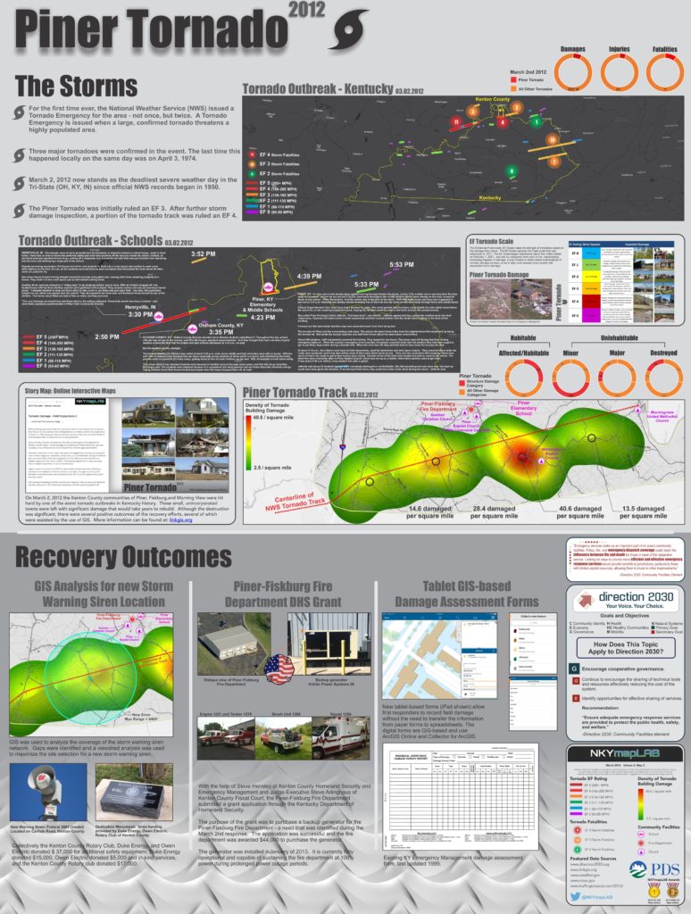
On March 2, 2012 the Kenton County communities of Piner, Fiskburg, and Morning View were hit hard by one of the worst tornado outbreaks in Kentucky history. These small, unincorporated towns were left with significant damage that would take years to rebuild. Originally classified as an EF-3 tornado (winds of 136-165 mph), the storm was upgraded to an EF-4 (166-200 mph) after damage survey teams saw first-hand the types of destruction that happened on the ground.
How significant was this storm?
● Four people were killed, and 17 more were injured
● Kenton County’s Homeland Security & Emergency Management Department reported that 349 primary structures (typically homes) and 700 secondary structures (outbuildings, barns, sheds) were impacted by this storm system. Eighty-eight buildings were completely destroyed.
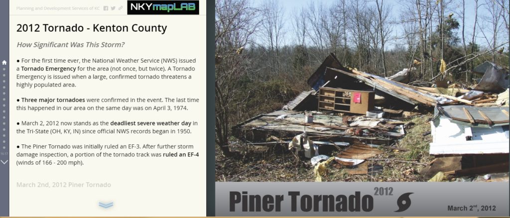
● For the first time ever, the National Weather Service (NWS) issued a Tornado Emergency for this area not once, but twice. A Tornado Emergency is issued when a large, confirmed tornado threatens a highly-populated area.
● Three major tornadoes were confirmed during the event. Historically, the last time three major tornadoes were confirmed in our area on the same day was on April 3, 1974 – the Xenia, OH tornado outbreak.
● March 2, 2012 now stands as the deadliest severe weather day in the Tri-State (OH, KY, IN) since the first official NWS records were filed in 1950.
Although the destruction was significant, there were several positive outcomes of the recovery efforts. The most important of these was a new emergency warning siren placed in the Piner community. Much of this project was funded with donations from Duke Energy, Owen Electric Cooperative, and the Rotary Club of Kenton County. Before the March 2nd tornado, no emergency warning siren or system existed in this area.
Another positive outcome was the successful grant application submitted by the Piner-Fiskburg Fire Department. This grant was used to purchase a new backup generator for the fire station, which previously did not have one. When the storm hit southern Kenton County, most fire stations were without power.
Finally, the paper damage assessment forms used by the Kentucky Emergency Management team to survey field damage have been upgraded to digital forms. First responders can now access the forms on a tablet device (such as an iPad) to record field damage, without the need to transfer the information from paper forms to spreadsheets.
POSTSCRIPT: The Story Map of which this map illustration is a part may be found here. By the end of this Story Map experience, viewers should have a better understanding of the 2012 Piner Tornado in Kenton County.
Click on the image above to view the Kenton County 2012 Piner Tornado Story Map.


