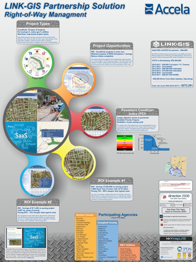
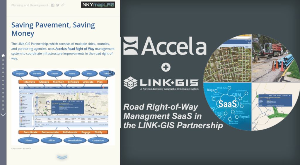
In 2010 the LINK-GIS partnership started using a collaborative software package called Accela. This Software As A Service (SaaS) implementation is accessed online, and is designed to encourage cooperation between cities, counties, and agencies when working in the community’s shared Right-of-Way (streets, utilities, and infrastructure projects).
The idea behind Accela is to have a 24/7 SaaS map-based coordination effort that leads to smarter, safer streets and savings of tax payer dollars.
When it comes to managing projects in the public right of way, communication and coordination is key. Accela’s cloud-based ROW management solution provides visibility into street activities, reduces the impact of infrastructure projects on residents and businesses, and saves time and money.
Key Features of Accela ROW Management solution
- Facilitate better communication and coordination between your agency, utilities and citizens
- Leverage real-time, map-based coordination to provide visibility into all projects and events
- Prevent potential safety and scheduling issues prior to construction
- Optimize limited budgets and maximize opportunity for cost-sharing
In addition to providing a more efficient ROW management platform, the LINK-GIS partnership has also noticed a direct Return-On-Investment (ROI) for its partners. Although ROI has not been consistently tracked since full implementation, there are several ROI case studies that highlight the benefits of using this service, and the tangible ROI that allows agencies to stretch their budgets even further than before.
Over the entire life-cycle of this implementation, the LINK-GIS partnership has realized over $272,000 in ROI for its members.
POSTSCRIPT: The Story Map of which this map illustration is a part may be found here. By the end of this Story Map experience, viewers will have a better understanding of the Accela implementation in the LINK-GIS Partnership.