Buttermilk Pike – Orphanage Road Realignment
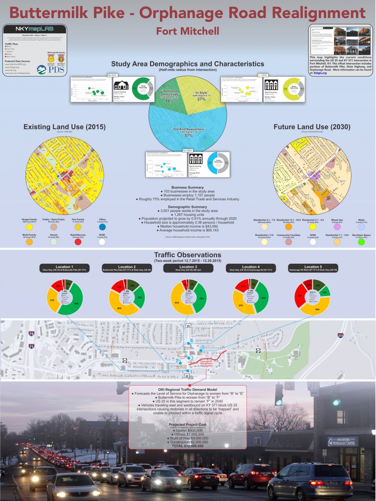
Kenton County’s Transportation Plan contains 22 transportation projects listed as “High Priority Recommendations.” One of these is the realignment of the Buttermilk Pike – Orphanage Road intersection in Fort Mitchell. This map highlights the current conditions surrounding this offset intersection of US 25 and KY 371 which includes portions of Buttermilk Pike, Dixie Highway, and Orphanage Road.
The image below represents the poster sized map of this project. There is also a companion Story Map, complete with interactive maps, narrative text, images and multimedia content.
As recently as 2013, over 25,000 vehicles traveled this stretch of Dixie Highway each day. This is due in part to the fact that US 25 and KY 371 offer two direct routes to Interstate 71/75, both about 1.2 miles away. It is also due to the intersection’s location in one of Northern Kentucky’s vibrant and historic commercial hubs.
The current challenges at this intersection are illustrated best through the work of Cincinnati’s Metropolitan Planning Organization, the Ohio-Kentucky-Indiana Regional Council of Governments (OKI). The agency’s Regional Traffic Demand Model:
● forecasts the Level of Service for Orphanage Road to worsen from “B” to “E”;
● forecasts Buttermilk Pike to worsen from “B” to “F”; and
● forecasts US 25 in this segment to remain “F” through 2040.
This is all because vehicles traveling east and westbound on KY 371 block US 25 intersections causing motorists in all directions to be “trapped” and unable to proceed within a traffic signal cycle.
This project also offers a more detailed demographic and business summary, obtained through Esri’s Business Analyst Online (December 2015).
POSTSCRIPT: The Story Map of which this map illustration is a part may be found here. By the end of this Story Map experience, viewers will have a better understanding of the Buttermilk – Orphanage Realignment project.

December NKYmapLAB Buttermilk – Orphanage Realignment map and poster
December NKYmapLAB Buttermilk – Orphanage Realignment map and poster
Kenton County’s Transportation Plan contains 22 transportation projects listed as “High Priority Recommendations.” One of these is the realignment of the Buttermilk Pike – Orphanage Road intersection in Fort Mitchell. This map highlights the current conditions surrounding this offset intersection of US 25 and KY 371 which includes portions of Buttermilk Pike, Dixie Highway, and Orphanage Road.
As recently as 2013, over 25,000 vehicles traveled this stretch of Dixie Highway each day. This is due in part to the fact that
US 25 and KY 371 offer two direct routes to Interstate 71/75, both about 1.2 miles away. It is also due to the intersection’s location in one of Northern Kentucky’s vibrant and historic commercial hubs.
The current challenges at this intersection are illustrated best through the work of Cincinnati’s Metropolitan Planning Organization, the Ohio-Kentucky-Indiana Regional Council of Governments (OKI). The agency’s Regional Traffic Demand Model:
● forecasts the Level of Service for Orphanage Road to worsen from “B” to “E”;
● forecasts Buttermilk Pike to worsen from “B” to “F”; and
● forecasts US 25 in this segment to remain “F” through 2040.
This is all because vehicles traveling east and westbound on KY 371 block US 25 intersections causing motorists in all directions to be “trapped” and unable to proceed within a traffic signal cycle.
This project also offers a more detailed demographic and business summary, obtained through Esri’s Business Analyst Online (December 2015).

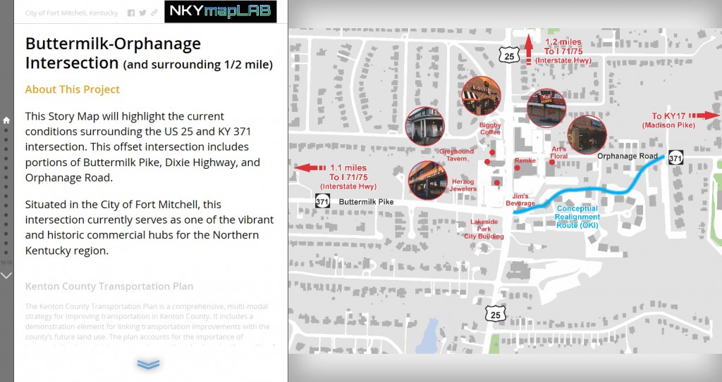
Click on the image above to view the Buttermilk Pike – Orphanage Road Realignment Story Map.

Click the logo for more information about the implementation of Direction 2030.


