

Current Conditions of Kenton County Bridges
This map shows all bridge structures in Kenton County tying them to recommended road projects from the 2014 Kenton County Transportation Plan.Current conditions information comes from the Federal Highway Administration’s National Bridge Inventory (NBI) and rates the bridges based on a combination of their characteristics. The bridge’s icon size illustrates its relative Average Daily Traffic count (ADT) and its color shows its sufficiency rating. Bridges without ADT information or sufficiency ratings are either not part of the NBI or represent a railroad line.
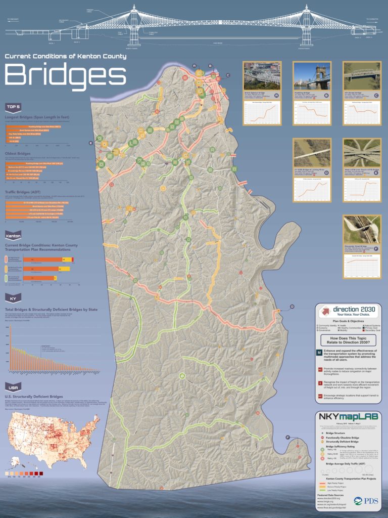
Current Condition of Kenton County Bridges

Click the logo for more information about the implementation of Direction 2030.