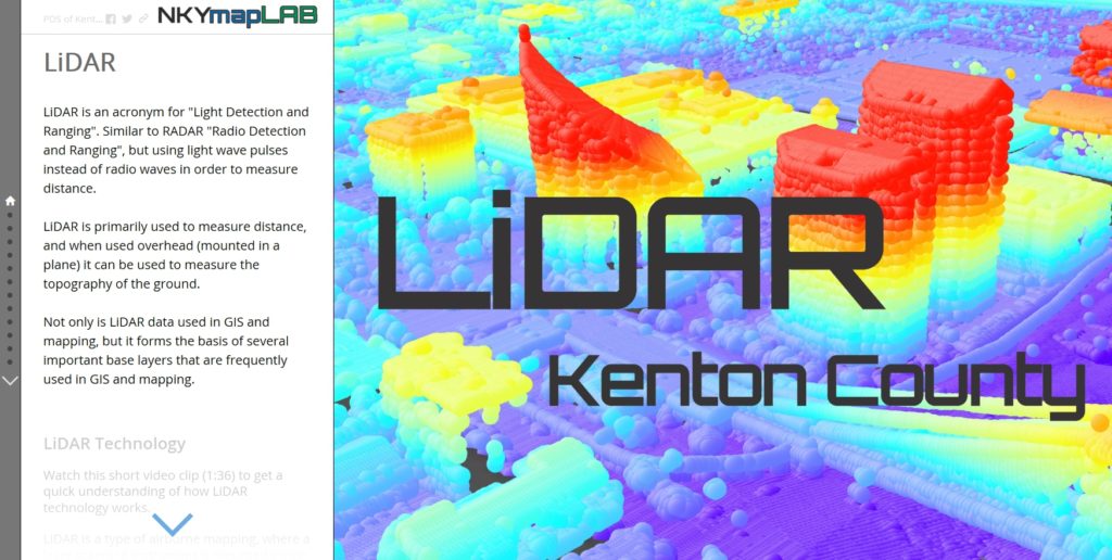
LiDAR data are used extensively for multiple purposes, either in their native format or as derivative products. LiDAR is an acronym for “Light Detection and Ranging.” Similar to RADAR (Radio Detection and Ranging) which uses radio waves, LiDAR uses light wave pulses to measure distance.
LiDAR is used primarily to measure distance. When used in airborne mapping (mounted in a plane), LiDAR can measure the topography of the ground. LiDAR uses a light scanning instrument that emits, and then records, the return of infrared light pulses at a rate of 100,000 to 400,000 times per second.
A small rotating mirror fans out the pulses, creating a sweeping effect for the measurements. As the aircraft moves forward, its sensor scans everything below that’s in its field of vision. As each pulse returns, it is recorded as an elevation value.
Here is a brief overview of how that process works.
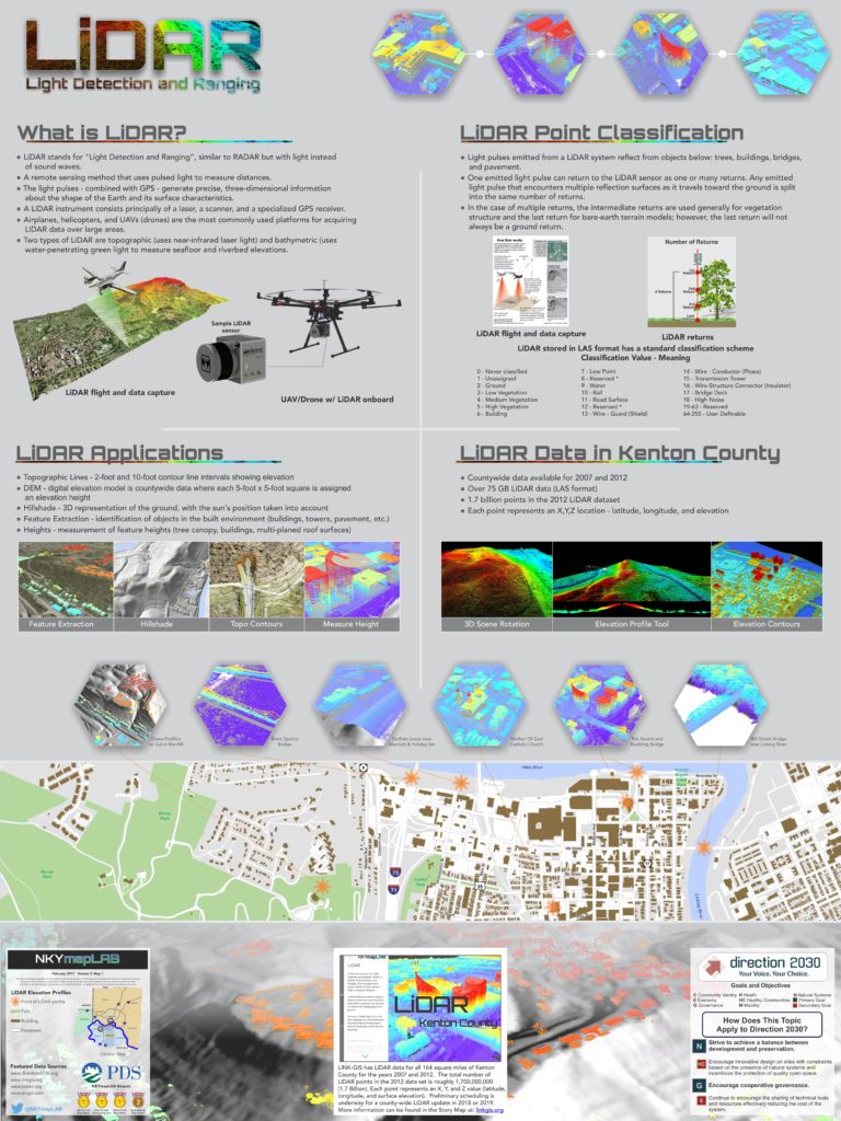
- Light pulses emitted from the LiDAR system reflect off of objects below: trees, ground, buildings, bridges, and pavement.
- Each emitted light pulse can return to the LiDAR sensor as one, or many returns. Any emitted light pulse that encounters multiple reflection surfaces as it travels toward the ground is split into the same number of returns.
- In the case of multiple returns, intermediate returns are used generally for vegetation structure, and the last return for bare-earth terrain models. The last return, however, will not always be a ground return.
Not only are LiDAR data used in GIS and mapping, they form the basis of several important base layers used frequently in them. LiDAR is used typically to create digital elevation models (DEMs), hillshade layers, and topographic contour lines. It is also used to detect landslides and even to extract automated features (identifying objects such as buildings).
LINK-GIS has over 75 GB of LiDAR data for Kenton County. The data cover all 164 square miles of the county, the product of flights from 2007 and 2012. The total number of LiDAR points in the 2012 data set is roughly 1,700,000,000 (1.7 Billion). Each point represents an X, Y, and Z value (latitude, longitude, and surface elevation).
Preliminary scheduling is underway for a county-wide LiDAR update in 2018 or 2019.
POSTSCRIPT: The Story Map of which this illustration is a part may be found here. By the end of this Story Map experience, viewers will have a better understanding of LiDAR data and its use in GIS.