
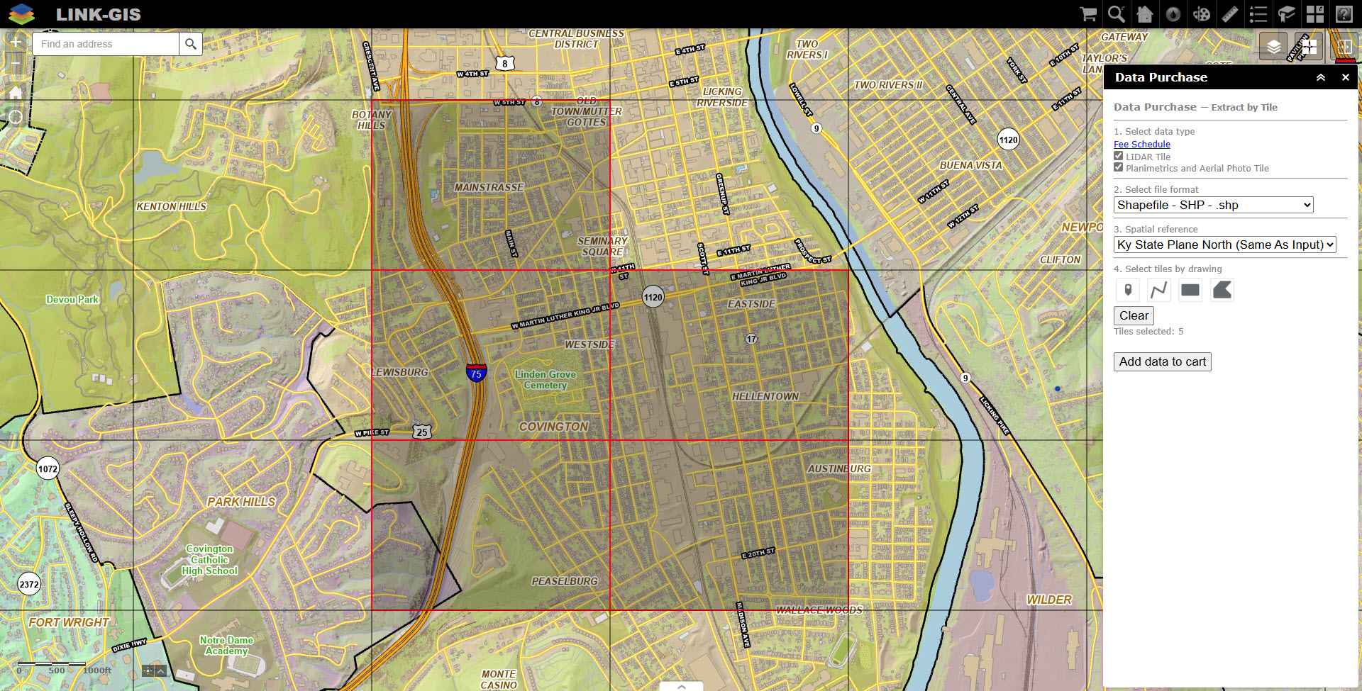
Purchase Aerial Photography, Planimetric and LiDAR data on a per tile basis. Use the Data Purchase map viewer to select the tiles of interest, then select which type of data to purchase and the format you would like the data in. Click here to begin.
The Planimetric data includes Building Footprints*, City Boundaries, Hydrant, Hydrology, Manhole*, Parcels, Parks, Railroad, Recreation, Road (Edge of Pavement)*, Sewer Line, Street Centerlines, Topography, Water Main & Zoning.
* Layer is available only for Campbell & Kenton County
Aerial Photography:
Imagery with 2″ resolution for Campbell County, Kenton County or Pendleton County (2025).
Cost: $50 per tile
Planimetric Data:
Available formats include Shapefile (.shp), File Geodatabase (.gdb), and DWG (.dwg). Aerial photography is included in the price when you buy planimetric data.
Cost: $50 per tile
LiDAR Data:
Point Cloud data in an LAS format
Cost: $50 per tile
