Northern Kentucky mapLAB will produce and distribute maps on a monthly basis using data supplied by LINK-GIS, and other featured data sources, as appropriate. Future maps will focus on a number of issues critical to economic development including quality of life.
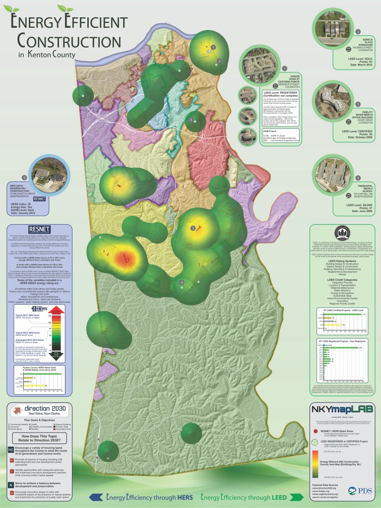
This map provides a visual analysis of energy efficient construction in Kenton County. It focuses specifically on two energy efficient construction programs, Leadership in Energy & Environmental Design (LEED) and the Home Energy Rating System (HERS) Index.
LEED is a credit-based certification system in which projects earn points for including various means of energy efficient design. HERS uses an index score in order to compare a home’s energy efficiency to a baseline home, and is a nationally-recognized scoring system.
The map shows locations of LEED and HERS projects along with a density analysis designed to identify clusters—or ‘hot spots’—of energy efficient construction. HERS projects shown on this map were constructed between 2012 and 2014 inclusive.
Non-HERS-rated residential construction that meets 2009 International Energy Conservation Code standards or better is not shown since it is now mandated across the state.


