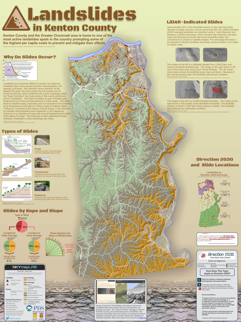
Kenton County and the Greater Cincinnati area is home to one of the most active landslides spots in the country prompting some of the highest per capita costs to prevent and mitigate their effects (Kentucky Geological Survey, 2013).
While landslides are somewhat difficult to predict, observed landslides often share several common characteristics: soil, geology, and slope. Soil moves downhill naturally, so the steeper the slope, the more severe the soil erosion can be. These two factors, when combined with a type of geology called “Kope Formation” which is common here can make areas of Kenton County particularly prone to landslides. Kope Formation (a type of blueish-gray shale) tends to be the dominant bedrock in many areas locally. This shale tends to weather easily, especially once it is exposed the elements.
When a type of material called “Colluvium” is present at the bottom of these slopes, it can often be an indicator that landslides have happened, or are happening. Colluvium is a collection of loose rock and soil fragments that collect at the base of a slope. The colluvium is often deposited through rain wash, sheet wash, or slow downslope soil creep.
This map includes the locations of existing and historic landslides in Kenton County. Location data are managed by the Kentucky Geological Survey (link). Approximately 42 percent of the landslides shown here have been documented (in person), while the remaining 58 percent are LiDAR-indicated. LiDAR-indicated landslides are identified using a “Light Detection and Ranging” (LiDAR) technology, which provides high-resolution elevation maps and derivative products that reveal landslides better than conventional air photos or satellite images (Crawford, 2012). The advantage of having these data is their potential to identify landslides previously undocumented or not visible on earlier maps.


