

This widget is designed to display community information for a property. Open the My Property widget by clicking the My Property icon in the LINK-GIS map viewer toolbar. The icon looks like a house.
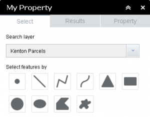 1. Begin by choosing a county from the “Search layer” drop down menu.
2. Choose a graphical selection type, then select parcels on the map viewer. There are ten options to choose from. Map tips will appear, as you hover your mouse over the map viewer, to assist with how to select parcels.
3. Once parcels are selected, the “Results” tab (the one that looks like a database table) will list the basic parcel information. Click on one of the records in this table to open the property information tab.
4. The “Property” information tab will 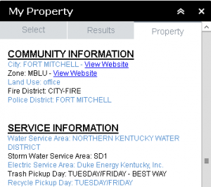 list the information available for the parcel.
5. Close the widget by clicking on the “x” in the upper right hand corner of the widget, or clicking its icon in the toolbar.