
Property Info Search Widget
This widget is designed to display community information for a property. Open the Property Info Search widget by clicking the House icon (1) in the LINK-GIS map viewer toolbar. This icon is the first one from left to right at the top-right corner of the screen when you open the map viewer.

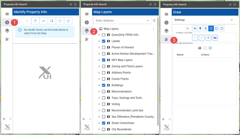
The widget has a left sidebar with three tab icons, and each one opens a different view:
- Tab 1 (i icon) → “Identify Property Info” — the search results panel (1)
- Tab 2 (layers/stack icon) → “Map Layers” — this is the actual table of contents with the checkboxes (2)
- Tab 3 (pencil/draw icon) → “Draw” — drawing settings and saved drawings (3)
Find Property Information
When you first open the widget, it opens to the Draw tab. To look up property information, click the i icon in the left sidebar to switch to the Identify Property Info tab.
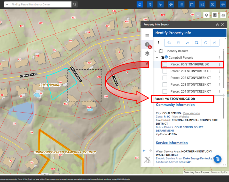
There are three options for selecting parcels. Once a selection method is chosen, it will remain active even if you close the widget. If the selected parcels span more than one county, results will be grouped by county.
Selection options
- Select by point. The cursor will appear as a plus sign with a semi-transparent gray circle. Click once on the map to select a parcel. A gray dot will mark where you clicked.
- Select by line or polygon. The cursor will appear as a plus sign with a small orange circle marking the last point placed. Click multiple times to trace around the parcels you want to select.
- Select by rectangle or circle. The cursor will appear as a plus sign. Click and hold to draw the selection area.
Results
For all three selection methods, a list of matching parcels appears under Identify Results. The first parcel is selected by default — its name appears as a header, with its Community Information and Service Information displayed below. Only the currently selected parcel is highlighted in cyan on the map. Click any other parcel in the list to move the highlight to that one.
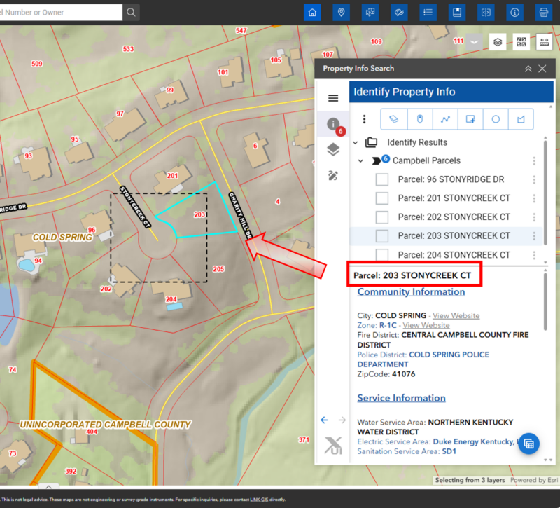
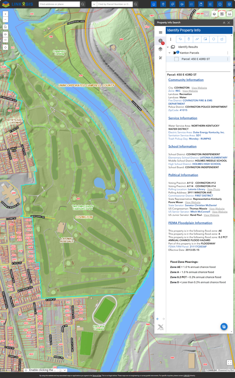
By default, the information displayed corresponds to the first item in the list. Browse through the list to view information for other items. Selecting a different item will update the highlighted parcel on the map to show only the currently selected one. Depending on data availability, the following list outlines the information you can expect to find for each searched property:
Community Information
- City.
- Zoning and Land Use.
- Fire and Police District.
- Zip code.
Service Information
- Water, Electric, Storm and Sanitation Service Area.
- Recycle and Trash Pickup Day.
School Information
- School District.
- Elementary, Middle and High School District.
- School Board.
Political Information
- Voting Precinct.
- Polling Location and Address.
- Commissioner District.
- State Representative.
- State Senator.
- US Congressman, US Senior Senator and US Junior Senator.
Flood Information
- FEMA Floodplain Information and Flood zone meaning.
Clear Selection
To clear the selection, go to the first button under My Property Info Search and click the Clear selection/drawing layer button. Selecting a new place or area will remove any previous results. Only the information about the last place you click on would be available.
Additional actions
As a byproduct, additional actions can be found for the selected data or individual items within the selection. These options can be accessed by clicking the three dots located in front of the Folder icon, the Black Arrow icon (which groups the selected parcels), or the Page icon (which itemizes each selected parcel)..
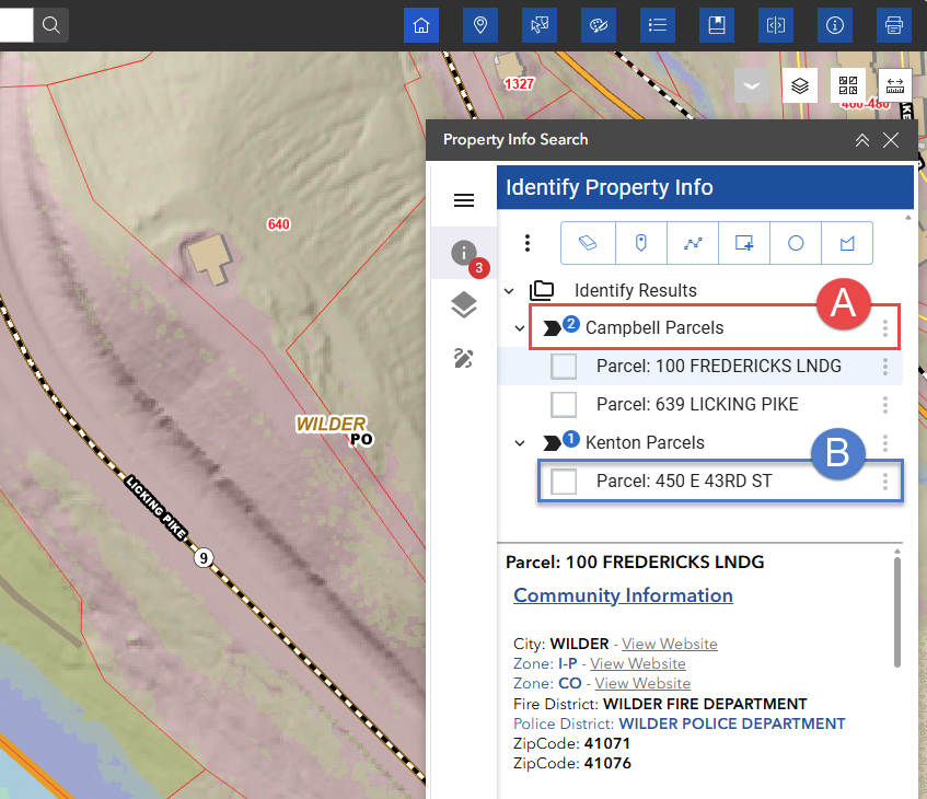
Folder Icon:
- Show all selected items grouped by County.
Arrow Icon (A):
- Zoom to selected extent.
- Attribute table. (Opens in a new window):
- Columns: Select the columns that you want to see or hide.
- Filters the data further.
- Export: Downloads as CSV file.
- Zoom to selected.
- Dock table/Return to floating table.
- Export to CVS.
- Select using all selected graphics.
- Buffer all selected graphics and select.
- Ungroup results.
- Save grouping preference.
- Export attributes only as PDF document.
Checkbox icon (B):
- Zoom to Location.
- Pan to location.
- Remove the parcel from the selection set.
- Select using graphic (Creates a selection polygon based on the shape of the selected parcel).
- Buffer all selected graphics and select.