• Menu
    • Home
    • Online Mapping
      • Explore the Maps
      • Metadata
    • Visit the Lab
    • Order Maps & Data
      • County-Wide Digital Data
      • Digital Data by Tile
      • Featured Maps
      • Historical Maps
      • NKYmapLAB Maps
    • Key Performance Indicators
    • How Do I…
      • Become a Business Client
      • Contact LINK-GIS
      • Find Flood Zones
      • Find My City
      • Find My Polling Location
      • Use the LINK-GIS Map Viewer
      • Use the Park Finder Map Viewer
      • Locate Survey Monuments
      • Retrieve Zoning Information
    • About LINK-GIS
      • About LINK-GIS
      • Contact LINK-GIS
        • Frequently Asked Questions
        • Control Network Recovery
      • LINK-GIS History: Achievements, Articles and Awards
      • Partners
      • GIS Team
    • Awards
  • Menu
    • Home
    • Online Mapping
      • Explore the Maps
      • Metadata
    • Visit the Lab
    • Order Maps & Data
      • County-Wide Digital Data
      • Digital Data by Tile
      • Featured Maps
      • Historical Maps
      • NKYmapLAB Maps
    • Key Performance Indicators
    • How Do I…
      • Become a Business Client
      • Contact LINK-GIS
      • Find Flood Zones
      • Find My City
      • Find My Polling Location
      • Use the LINK-GIS Map Viewer
      • Use the Park Finder Map Viewer
      • Locate Survey Monuments
      • Retrieve Zoning Information
    • About LINK-GIS
      • About LINK-GIS
      • Contact LINK-GIS
        • Frequently Asked Questions
        • Control Network Recovery
      • LINK-GIS History: Achievements, Articles and Awards
      • Partners
      • GIS Team
    • Awards

Help Widget


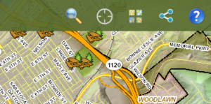
To view more information and help about the Park Finder map, click on the help button, the fifth widget in the toolbar.

  • Home
  • How Do I…
  • Use the Park Finder Map Viewer
  • Help Widget

How Do I…

  • Become a Business Client
  • Contact LINK-GIS
  • Find Flood Zones
  • Find My City
  • Find My Polling Location
  • Use the LINK-GIS Map Viewer
    • About Widget
    • Basemap Gallery
    • Basemap Mashup Widget
    • Bookmark Widget
    • Coordinate Widget
    • Draw Widget
    • Enhanced Search Widget
    • Find an Address
    • Flood Widget
    • Legend Widget
    • Measure Widget
    • More Map Layers – Turning On and Off
    • My Property Info Widget
    • Navigation Controls
    • Opening the Viewer
    • Pictometry Widget
    • Pop-ups
    • Print Widget
    • Swipe
    • Toolbar
  • Use the Park Finder Map Viewer
    • Basemap Widget
    • Help Widget
    • Locate Widget
    • Navigation Controls
    • Opening the Park Finder Map
    • Pop-ups
    • Search Widget
    • Share Widget
    • Toolbar
  • Locate Survey Monuments
  • Retrieve Zoning Information

LINK-GIS Disclaimer  •  Copyright @2016  •  Planning and Development Services of Kenton County