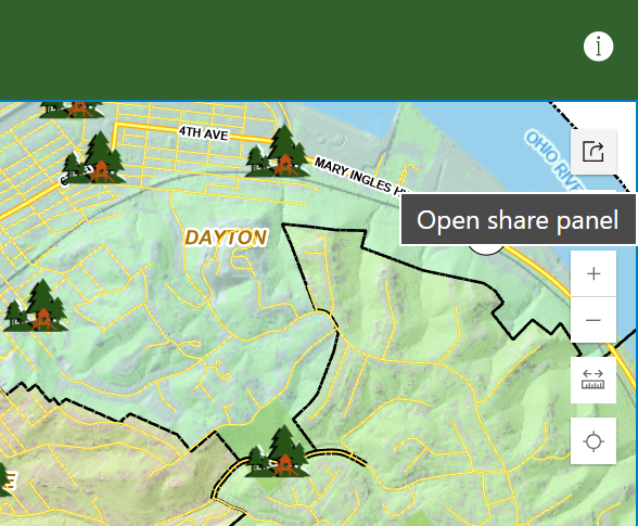
• Menu
    • Home
    • Online Mapping
      • Explore the Maps
      • Metadata
    • Visit the Lab
    • Order Maps & Data
      • County-Wide Digital Data
      • Digital Data by Tile
      • Featured Maps
      • Historical Maps
      • NKYmapLAB Maps
    • Key Performance Indicators
    • How Do I…
      • Become a Business Client
      • Contact LINK-GIS
      • Find Flood Zones
      • Find My City
      • Find My Polling Location
      • Use the LINK-GIS Map Viewer
      • Use the Park Finder Map Viewer
      • Locate Survey Monuments
      • Retrieve Zoning Information
    • About LINK-GIS
      • About LINK-GIS
      • Contact LINK-GIS
        • Frequently Asked Questions
        • Control Network Recovery
      • LINK-GIS History: Achievements, Articles and Awards
      • Partners
      • GIS Team
    • Awards
  • Menu
    • Home
    • Online Mapping
      • Explore the Maps
      • Metadata
    • Visit the Lab
    • Order Maps & Data
      • County-Wide Digital Data
      • Digital Data by Tile
      • Featured Maps
      • Historical Maps
      • NKYmapLAB Maps
    • Key Performance Indicators
    • How Do I…
      • Become a Business Client
      • Contact LINK-GIS
      • Find Flood Zones
      • Find My City
      • Find My Polling Location
      • Use the LINK-GIS Map Viewer
      • Use the Park Finder Map Viewer
      • Locate Survey Monuments
      • Retrieve Zoning Information
    • About LINK-GIS
      • About LINK-GIS
      • Contact LINK-GIS
        • Frequently Asked Questions
        • Control Network Recovery
      • LINK-GIS History: Achievements, Articles and Awards
      • Partners
      • GIS Team
    • Awards

Share Widget


You can click on the Share Map button, the fourth widget in the Park Finder map viewer toolbar, to share your map several different ways. You can compose an email, post to your Facebook wall or post a Tweet. When you use the Facebook or Twitter links, you’ll be asked to sign in to your respective account.

  • Home
  • How Do I…
  • Use the Park Finder Map Viewer
  • Share Widget

How Do I…

  • Become a Business Client
  • Contact LINK-GIS
  • Find Flood Zones
  • Find My City
  • Find My Polling Location
  • Use the LINK-GIS Map Viewer
    • About Widget
    • Basemap Gallery
    • Basemap Mashup Widget
    • Bookmark Widget
    • Coordinate Widget
    • Draw Widget
    • Enhanced Search Widget
    • Find an Address
    • Flood Widget
    • Legend Widget
    • Measure Widget
    • More Map Layers – Turning On and Off
    • My Property Info Widget
    • Navigation Controls
    • Opening the Viewer
    • Pictometry Widget
    • Pop-ups
    • Print Widget
    • Swipe
    • Toolbar
  • Use the Park Finder Map Viewer
    • Basemap Widget
    • Help Widget
    • Locate Widget
    • Navigation Controls
    • Opening the Park Finder Map
    • Pop-ups
    • Search Widget
    • Share Widget
    • Toolbar
  • Locate Survey Monuments
  • Retrieve Zoning Information

LINK-GIS Disclaimer  •  Copyright @2016  •  Planning and Development Services of Kenton County