
Select for Table
Open the Select for Table widget
At the bottom of the screen, in the LINK-GIS map viewer you’ll find an interactive table that displays additional information about the parcels shown on the map. To visualize this content, click on the Select for Table widget (1), it is the third icon from left to right, on the top right of the map viewer, activate the widget and choose the parcels of interest.
The selected parcels will be highlighted in cyan, and their attributes will also appear in the interactive table at the bottom of the map viewer. If your selection includes parcels from multiple counties, each county’s parcels will be displayed in a separate table.
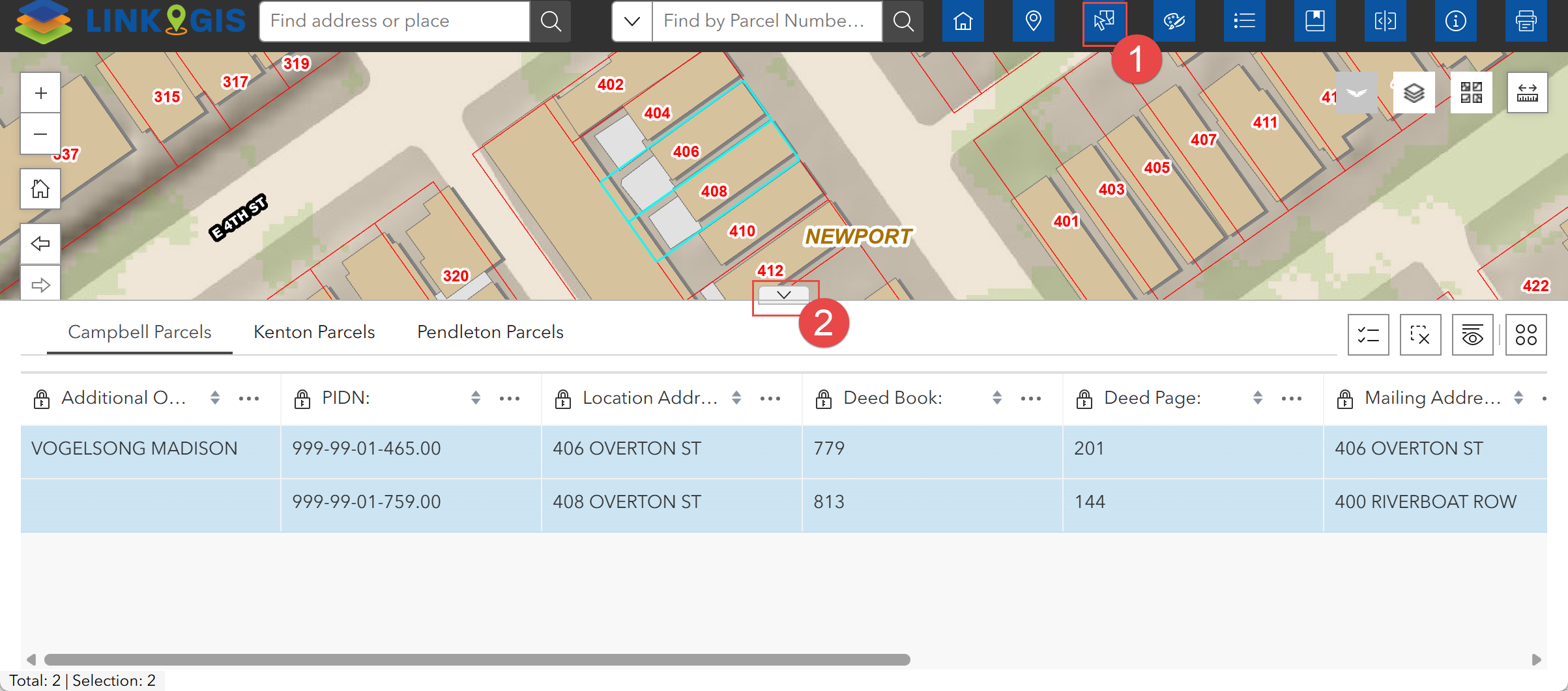
Each tab in the table corresponds to a different county, for that reason the total number of selected parcels per county is shown at the bottom of each table. Also, the parcel count is shown next to each layer name in the selection dialog box. To minimize or expand the table, click the arrow icon (2) at the bottom of the map viewer.
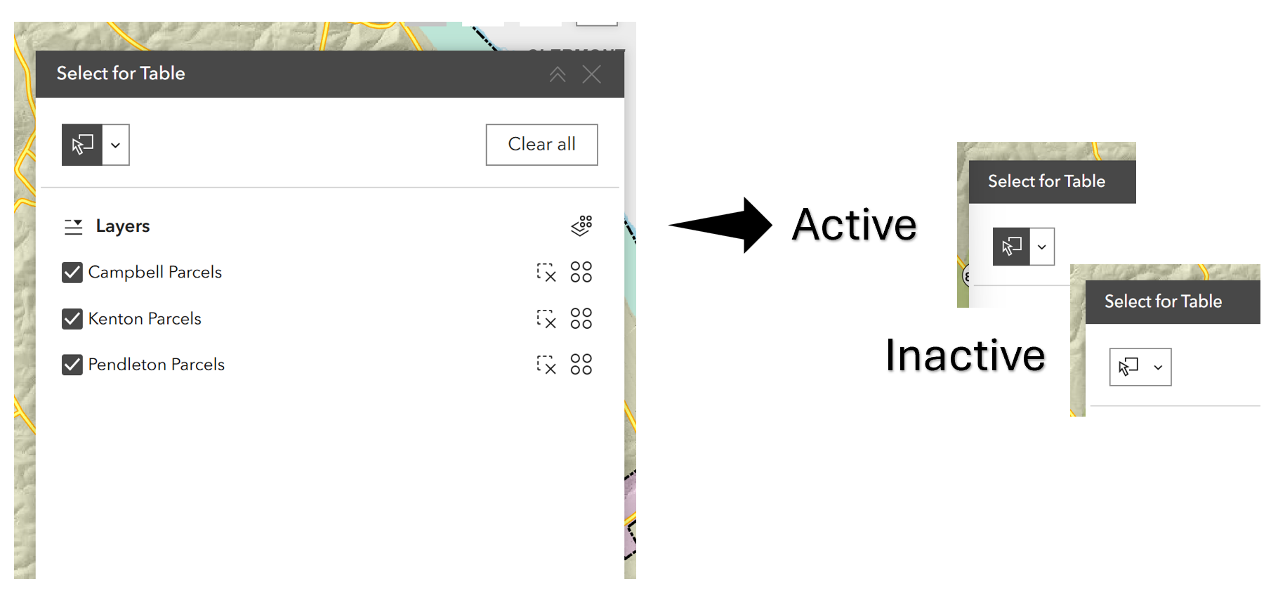
Activate the selection tool
To activate the “Select by Table” widget, click the arrow inside the dialog box. When the dialog box first opens, the selection arrow appears inactive (black arrow on a white background). Once activated, it changes to a white arrow on a black background.
Choose a selection mode
Hovering over the arrow reveals the options:
- New selection: Draw a shape
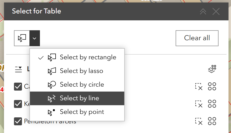
- Add to current selection: Shift + Draw
- Remove from current selection: Ctrl + Draw
- Select subset from current selection: Shift + Ctrl + Draw
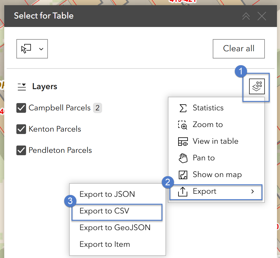
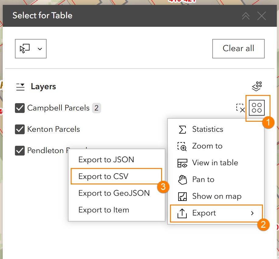
- Additional actions are available next to each individual set of parcels (Parcels are grouped by county)
After you finish editing, remember to turn it back off; otherwise, the tool will remain active even if the dialog box is closed.
Manage the dialog box
The same actions that can be applied to the entire selection (blue) are also available for individual counties (orange), but they are triggered by icons located in different places. See below:
The dialog box is fixed in position but can be minimized by clicking the collapse button at its top right. Your selection will remain active regardless of whether the box is closed. To reopen it, click the expand button or click the Select for Table icon again.
