• Menu
    • Home
    • Online Mapping
      • Explore the Maps
      • Metadata
    • Visit the Lab
    • Order Maps & Data
      • County-Wide Digital Data
      • Digital Data by Tile
      • Featured Maps
      • Historical Maps
      • NKYmapLAB Maps
    • Key Performance Indicators
    • How Do I…
      • Become a Business Client
      • Contact LINK-GIS
      • Find Flood Zones
      • Find My City
      • Find My Polling Location
      • Use the LINK-GIS Map Viewer
      • Use the Park Finder Map Viewer
      • Locate Survey Monuments
      • Retrieve Zoning Information
    • About LINK-GIS
      • About LINK-GIS
      • Contact LINK-GIS
        • Frequently Asked Questions
        • Control Network Recovery
      • LINK-GIS History: Achievements, Articles and Awards
      • Partners
      • GIS Team
    • Awards
  • Menu
    • Home
    • Online Mapping
      • Explore the Maps
      • Metadata
    • Visit the Lab
    • Order Maps & Data
      • County-Wide Digital Data
      • Digital Data by Tile
      • Featured Maps
      • Historical Maps
      • NKYmapLAB Maps
    • Key Performance Indicators
    • How Do I…
      • Become a Business Client
      • Contact LINK-GIS
      • Find Flood Zones
      • Find My City
      • Find My Polling Location
      • Use the LINK-GIS Map Viewer
      • Use the Park Finder Map Viewer
      • Locate Survey Monuments
      • Retrieve Zoning Information
    • About LINK-GIS
      • About LINK-GIS
      • Contact LINK-GIS
        • Frequently Asked Questions
        • Control Network Recovery
      • LINK-GIS History: Achievements, Articles and Awards
      • Partners
      • GIS Team
    • Awards

Analytics show new GIS website capabilities increase user traffic

January 4, 2017

LINGISweb
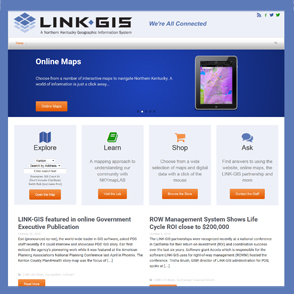
PDS’ new LINK-GIS website experienced a 49 percent increase in unique visitors during the first quarter of FY17 compared to the first quarter of FY16, according to Google Analytics. That increase in unique visitors drove an increase in the number of sessions by 70 percent during the same period.

Unique visitors are determined by the IP or internet protocol address of the device that visits the website. Sessions are groups of pages that the user visits before exiting the site, either by going to another site or closing the browsing window.

“Our site’s new content works well on mobile devices,” said Christy Powell, GISP, PDS’ senior GIS programmer. “We’re seeing more users across more devices accessing our site. Much of that increase in sessions is attributable to visitors using the interactive maps on their mobile devices.”

The main LINK-GIS MapViewer showed a 174 percent increase in sessions for the first quarter of FY17 versus the same quarter of FY16.

Page views have increased by 44 percent during this time.

“Much of this increase is due to additional content we added during the update,” said Joe Busemeyer, PDS’ principal GIS programmer. “We wanted the end user to have better access to our maps and especially the NKYmapLAB content.”

Time spent using the MapViewer has decreased over 30 seconds on average from two minutes three seconds to one minute 28 seconds.

“Quicker load times and easier-to-use tools are responsible for getting answers to users faster,” said Powell.

Powell and Busemeyer will use the insights gained from Google Analytics to continue to improve the LINK-GIS website over the next year.

Data Development, LINK-GIS News, Outreach, Technology
GIS, Google Analytics, LINK-GIS, Map Viewer, PDS, Programmer, Website
GIS staff earns recognitions during annual KAMP conference
GIS staffer prepares for presidency of state mapping organization
  • Home
  • LINK-GIS News
  • Technology
  • Outreach
  • Data Development
  • Analytics show new GIS website capabilities increase user traffic

Recent Posts

  • Adjusted Operation Details for LINK-GIS
  • How You Can Vote in the Kenton County General Election-November 3, 2020
  • Adjusted Operation Details for LINK-GIS
  • Request for Proposals
  • LINK-GIS Adds Pictometry Widget to the Map Viewer

Archives

  • November 2020
  • October 2020
  • March 2020
  • January 2020
  • March 2019
  • August 2018
  • June 2018
  • December 2017
  • November 2017
  • September 2017
  • August 2017
  • July 2017
  • May 2017
  • April 2017
  • March 2017
  • February 2017
  • January 2017
  • October 2016
  • August 2016
  • July 2016
  • June 2016
  • March 2016
  • December 2015
  • October 2015
  • August 2015
  • February 2015
  • December 2014
  • October 2014
  • August 2014
  • July 2014
  • May 2014
  • April 2014
  • March 2014
  • February 2014
  • December 2013
  • November 2013
  • September 2013
  • August 2013
  • May 2013
  • March 2013
  • March 2012
  • January 2012
  • December 2011
  • February 2011
  • October 2010
  • September 2010
  • August 2010
  • July 2010
  • June 2010
  • March 2010
  • February 2010
  • January 2010
  • December 2009
  • November 2009
  • October 2009
  • September 2009
  • April 2009
  • March 2009
  • October 2008
  • August 2008
  • July 2008
  • May 2008
  • April 2008
  • March 2008
  • January 2008
  • December 2007
  • October 2007
  • August 2007
  • June 2007
  • May 2007
  • April 2007
  • February 2007
  • January 2007
  • November 2006
  • October 2006
  • August 2006
  • June 2006
  • May 2006
  • April 2006
  • February 2006
  • January 2006
  • December 2005
  • September 2005
  • April 2005
  • March 2005
  • February 2005
  • October 2003

Categories

  • Collaboration
  • Data Development
  • Financial Benefit
  • LINK-GIS News
  • NKYmapLAB
  • Outreach
  • Recognition
  • Technology
  • Uncategorized

LINK-GIS Disclaimer  •  Copyright @2016  •  Planning and Development Services of Kenton County