• Menu
    • Home
    • Online Mapping
      • Explore the Maps
      • Metadata
    • Visit the Lab
    • Order Maps & Data
      • County-Wide Digital Data
      • Digital Data by Tile
      • Featured Maps
      • Historical Maps
      • NKYmapLAB Maps
    • Key Performance Indicators
    • How Do I…
      • Become a Business Client
      • Contact LINK-GIS
      • Find Flood Zones
      • Find My City
      • Find My Polling Location
      • Use the LINK-GIS Map Viewer
      • Use the Park Finder Map Viewer
      • Locate Survey Monuments
      • Retrieve Zoning Information
    • About LINK-GIS
      • About LINK-GIS
      • Contact LINK-GIS
        • Frequently Asked Questions
        • Control Network Recovery
      • LINK-GIS History: Achievements, Articles and Awards
      • Partners
      • GIS Team
    • Awards
  • Menu
    • Home
    • Online Mapping
      • Explore the Maps
      • Metadata
    • Visit the Lab
    • Order Maps & Data
      • County-Wide Digital Data
      • Digital Data by Tile
      • Featured Maps
      • Historical Maps
      • NKYmapLAB Maps
    • Key Performance Indicators
    • How Do I…
      • Become a Business Client
      • Contact LINK-GIS
      • Find Flood Zones
      • Find My City
      • Find My Polling Location
      • Use the LINK-GIS Map Viewer
      • Use the Park Finder Map Viewer
      • Locate Survey Monuments
      • Retrieve Zoning Information
    • About LINK-GIS
      • About LINK-GIS
      • Contact LINK-GIS
        • Frequently Asked Questions
        • Control Network Recovery
      • LINK-GIS History: Achievements, Articles and Awards
      • Partners
      • GIS Team
    • Awards

Know your boundaries: GIS and GPS saves local county thousands

August 29, 2014

PendCo
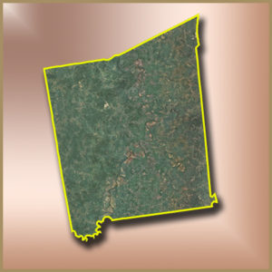
When looking for a summer treat, Rocky Road ice cream may come to mind, but a true rocky road is never a treat. Pendleton County Public Works Director Tim Antrobus received a call from an adjoining county inquiring about road repairs on Oscar Spradling Road. Oscar Spradling had turned into a “rocky road” and the determination of the county line and ownership was in question.

Once Antrobus received the inquiry he turned to Mike Moore, Pendleton County Emergency Services Director. Moore was able to give him the Global Positioning System (GPS) coordinates of where he believed the county line was located. Moore then turned to PDS to locate the county boundary line. When looking at landmarks and the GIS, it appeared that the project extent proposed by the contiguous county showed a 300 foot difference from the documentation that Pendleton County possessed.

Antrobus attended a scheduled meeting to review the boundary line with the adjacent county and mentioned he used GPS points to determine the extent of the road project. The opposing county asked, “What are GPS points?” Antrobus responded, “A good place to start.”

Equipped with the substantial data, the neighboring county took on the 300 feet mapped by LINK-GIS and GPS. As a result Pendleton County public works crew saved at least two full days of work and upwards of $5,000 in materials.

The Global Positioning System (GPS) is a space-based satellite navigation system that provides location anywhere on Earth.

Collaboration, Financial Benefit, Technology, Uncategorized
Boundaries, GIS, GPS, LINK-GIS, Local County, Pendleton, Public Works, Saves, Thousands
STEM: Ripe for the picking
LINK-GIS partners receive final delivery of 2014 aerial photography
  • Home
  • Uncategorized
  • Technology
  • Financial Benefit
  • Collaboration
  • Know your boundaries: GIS and GPS saves local county thousands

Recent Articles

  • Adjusted Operation Details for LINK-GIS
  • How You Can Vote in the Kenton County General Election-November 3, 2020
  • Adjusted Operation Details for LINK-GIS

Archives

  • November 2020
  • October 2020
  • March 2020
  • January 2020
  • March 2019
  • August 2018
  • June 2018
  • December 2017
  • November 2017
  • September 2017
  • August 2017
  • July 2017
  • May 2017
  • April 2017
  • March 2017
  • February 2017
  • January 2017
  • October 2016
  • August 2016
  • July 2016
  • June 2016
  • March 2016
  • December 2015
  • October 2015
  • August 2015
  • February 2015
  • December 2014
  • October 2014
  • August 2014
  • July 2014
  • May 2014
  • April 2014
  • March 2014
  • February 2014
  • December 2013
  • November 2013
  • September 2013
  • August 2013
  • May 2013
  • March 2013
  • March 2012
  • January 2012
  • December 2011
  • February 2011
  • October 2010
  • September 2010
  • August 2010
  • July 2010
  • June 2010
  • March 2010
  • February 2010
  • January 2010
  • December 2009
  • November 2009
  • October 2009
  • September 2009
  • April 2009
  • March 2009
  • October 2008
  • August 2008
  • July 2008
  • May 2008
  • April 2008
  • March 2008
  • January 2008
  • December 2007
  • October 2007
  • August 2007
  • June 2007
  • May 2007
  • April 2007
  • February 2007
  • January 2007
  • November 2006
  • October 2006
  • August 2006
  • June 2006
  • May 2006
  • April 2006
  • February 2006
  • January 2006
  • December 2005
  • September 2005
  • April 2005
  • March 2005
  • February 2005
  • October 2003

LINK-GIS Disclaimer  •  Copyright @2016  •  Planning and Development Services of Kenton County