
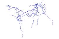
TANK Bus Routes (Campbell and Kenton Counties)
Tags
Updated as of 2013 Bus Routes for each OKI County, TANK, Bus, Routes
Summary
This data was compiled from information given from BCRTA, CTC, MTS, SORTA, TANK, and Warren County transit services.
Description
objectid: a given number to identify each route within this file
route: number or color given to each route by its respctive transit authority. Some routes have an X which denotes that it is an express route
mode: 1 indicates the bus is a regular route. 2 indicates that it is an express route
URL: a link to the transit company’s description of the route
Company: Southwest Ohio Regional Transit Authority(SORTA), operates Metro buses within Cincinnati; Transit Authority of Northern Kentucky(TANK), operates busses within northern Kentucky; Clermont Transit Connection(CTC), operates buses within Clermont county; Butler County Regional Transit Authority(BCRTA),operates Regional Transit Services, Oxford and Miami University Service and Middletown Transit Services(MTS)
Warren County has on demand transit service. More details can be found here: http://www.co.warren.oh.us/humanservices/socialServices/transportation.aspx
Credits
BCRTA,CTC, MTS SORTA, TANK, and Warren County transit services.
Use limitations
LINK-GIS makes no representations, guarantees, or warranties as to the accuracy, completeness, currency, or suitability of information provided. LINK-GIS specifically disclaims any and all liability for any claims or damages that may result from providing this information, including any websites maintained by third parties and linked to this data. LINK-GIS makes no effort to independently verify, and does not exert editorial control over information on pages outside of the “linkgis.org” domain.
LINK-GIS value added data, LINK-GIS and any of its partners or employees except no liability for use of this data.
Extent
| West | -84.729560 | East | -84.392156 |
| North | 39.116476 | South | 38.858560 |
Scale Range
| Maximum (zoomed in) | 1:5,000 |
| Minimum (zoomed out) | 1:150,000,000 |
Campbell County
- Address Points
- Buildings
- Building Accessories
- Centerlines
- City Boundaries
- Condominiums
- County Boundary
- Parcels
- Representative Districts
- Roads (edge of pavement)
- School Districts
- School Facilities
- Senatorial Districts
- Voting Polls
- Voting Precincts
- Zip Codes
- Zoning
Kenton County
- Address Points
- Buildings
- Centerlines
- City Boundaries
- Condominiums
- County Boundary
- Parcels
- Police Stations
- Roads (edge of pavement)
- Representative Districts
- School Districts
- School Facilities
- Senatorial Districts
- Sidewalks
- Voting Polls
- Voting Precincts
- Zip Codes
- Zoning
Pendleton County
- Aerial Photography 2020
- Aircare Landing Zones
- Buildings
- Centerlines
- City Boundaries
- County Boundary
- Geology
- Parcels
- Railroads
- Representative Districts
- School Board
- School Facilities
- Senatorial Districts
- Soils
- Topography
- Voting Polls
- Voting Precincts
Region
- Aerial Photography 2023 (CC and KC)
- Aerial Photography 2025
- Aircare Landing Zones (CC and KC)
- Control Points
- Creeks and Streams (CC and KC)
- Geology (CC and KC)
- Hospitals
- Libraries
- Museums
- NKWD – Hydrants (CC and KC)
- NKWD – Water Mains (CC and KC)
- Parks
- Railroads (CC and KC)
- SD1 – Sanitary Lines (CC and KC)
- SD1 – Sanitary Structures (CC and KC)
- SD1 – Storm Lines (CC and KC)
- SD1 – Storm Structures (CC and KC)
- Soils (CC and KC)
- Swimming Pools (CC and KC)
- Topography (CC and KC)
- Watersheds
