
Lodging (Campbell, Kenton and Pendleton Counties)
Tags
Lodging, Hotels, Motels, Bed and Breakfast, Kenton, Campbell, Pendleton, Northern Kentucky
Summary
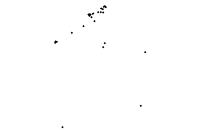
The purpose of this data is to show the location of Lodging Facilities in Northern Kentucky.
Description
This feature class shows the locations of Lodging Facilities in Northern Kentucky. The data originated from the Northern Kentucky Health Department. LINK-GIS has updated and added value to the data by adding address, phone number and website information where applicable.
Credits
Northern Kentucky Health Department (NKHD), LINK-GIS, Planning and Development Services of Kenton County (PDS)
Use limitations
LINK-GIS makes no representations, guarantees, or warranties as to the accuracy, completeness, currency, or suitability of information provided. LINK-GIS specifically disclaims any and all liability for any claims or damages that may result from providing this information, including any websites maintained by third parties and linked to this data. LINK-GIS makes no effort to independently verify, and does not exert editorial control over information on pages outside of the “linkgis.org” domain.
LINK-GIS value added data, LINK-GIS and any of its partners or employees except no liability for use of this data
Extent
| West | -84.617167 | East | -84.357880 |
| North | 39.106378 | South | 38.844372 |
Scale Range
| Maximum (zoomed in) | 1:5,000 |
| Minimum (zoomed out) | 1:150,000,000 |
Campbell County
- Address Points
- Buildings
- Building Accessories
- Centerlines
- City Boundaries
- Condominiums
- County Boundary
- Parcels
- Representative Districts
- Roads (edge of pavement)
- School Districts
- School Facilities
- Senatorial Districts
- Voting Polls
- Voting Precincts
- Zip Codes
- Zoning
Kenton County
- Address Points
- Buildings
- Centerlines
- City Boundaries
- Condominiums
- County Boundary
- Parcels
- Police Stations
- Roads (edge of pavement)
- Representative Districts
- School Districts
- School Facilities
- Senatorial Districts
- Sidewalks
- Voting Polls
- Voting Precincts
- Zip Codes
- Zoning
Pendleton County
- Aerial Photography 2020
- Aircare Landing Zones
- Buildings
- Centerlines
- City Boundaries
- County Boundary
- Geology
- Parcels
- Railroads
- Representative Districts
- School Board
- School Facilities
- Senatorial Districts
- Soils
- Topography
- Voting Polls
- Voting Precincts
Region
- Aerial Photography 2023 (CC and KC)
- Aerial Photography 2025
- Aircare Landing Zones (CC and KC)
- Control Points
- Creeks and Streams (CC and KC)
- Geology (CC and KC)
- Hospitals
- Libraries
- Museums
- NKWD – Hydrants (CC and KC)
- NKWD – Water Mains (CC and KC)
- Parks
- Railroads (CC and KC)
- SD1 – Sanitary Lines (CC and KC)
- SD1 – Sanitary Structures (CC and KC)
- SD1 – Storm Lines (CC and KC)
- SD1 – Storm Structures (CC and KC)
- Soils (CC and KC)
- Swimming Pools (CC and KC)
- Topography (CC and KC)
- Watersheds
