
LINK-GIS Timeline
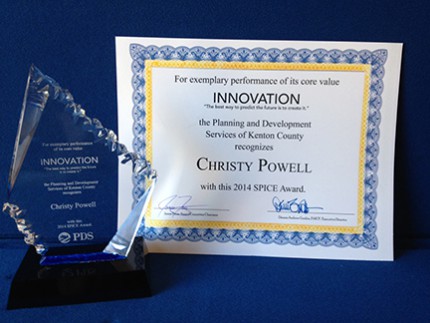
Christy Powell, GISP, receives the PDS SPICE award for Innovation for the work she did creating a bike and pedestrian count application and a building damage assessment application for emergency situations.
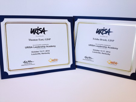
Tom East, GISP, and Trisha Brush, GISP, receive certification from URISA for completing the URISA Leadership Academy.
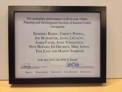
LINK-GIS staffers, Christy Powell, GISP, Joe Busemeyer, GISP and Tom East, GISP, are presented with the 2014 ALL-SPICE award for their contributions to the Kenton County 2030 Comprehensive Plan project, in conjunction with members of the PDS Planning Department.

Joe Busemeyer, GISP, presented on the Covington Asset Management project at the ESRI 2011 International User Conference and also submitted map to large format map gallery.

Christy Powell, GISP, has an article published in GeoWorld magazine, November 2011, Special Government Issue.
LINK-GIS staff, Christy Powell, GISP and Joe Busemeyer, GISP, develop and roll out ‘Snow Tracker’, an interactive map for Kenton County Public works to show the public what roads have been treated during a snow event.
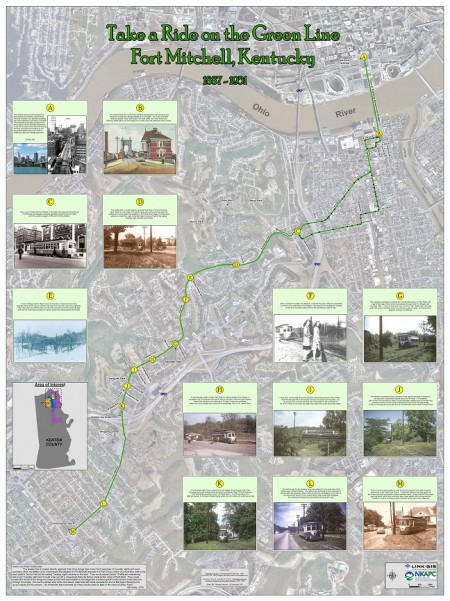
LINK-GIS staffer, Joe Busemeyer, GISP, creates a detailed map showing the history of the Green Line streetcar that ran from downtown Cincinnati to Fort Mitchell, KY. The map is featured in the opening ceremony for the ESRI International User Conference.
