Use this survey to report issues on any road in Kenton County, Kentucky. You can report items such as: potholes, standing water, flooding, damaged or missing road signs, dead animals, falling or sliding pavement, erosion, street light damage or outage, traffic light issues, or guardrail damage. Your response will be automatically forwarded to the appropriate city, county, or state agency responsible for maintaining the road identified in your submission.
Want easier access? Add a shortcut to your phone’s home screen and use it anytime here – no app needed.

This interactive dashboard provides a visual summary of road condition reports collected over time and allows the end user to add filters to focus on specific dates, types of reports or jurisdictions.

Road Reporter Data Management Dashboard
Coming Soon!
Query-based Applications designed to quickly find the Elementary, Middle and High school for a specified address, in Kenton County. This application returns a text result, without opening a map.

Web Map Application designed to coordinate right-of-way projects that require pavement removal with Cities, Utility Providers, and County Departments in Northern Kentucky to collaborate and save time and money! For training videos and more information click here.
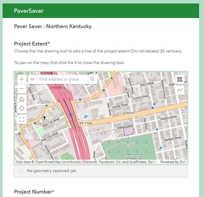
Project Entry Form
Start a new project entry by clicking the image above—this also sends emails to contacts for potential coordination of projects.
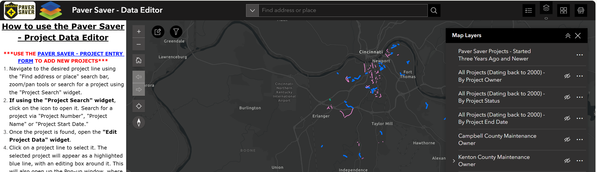
Data Editor Web Application
Click the image above to open the Data Editor Web Application, which enables users to edit existing projects; also triggering emails to be sent to contacts for potential coordination of projects.
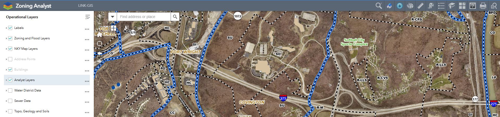
Web Map Application designed specifically for the needs of the PDS Zoning Administration & Code Enforcement departments.
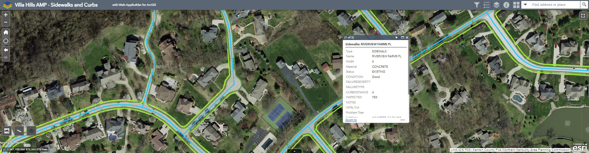
The LINK-GIS team has built several Web Map Applications designed specifically to help the cities and county departments collect assets, such as signs, sidewalks, curbs, culverts and guardrails. These web apps are designed for field use and leverage a combination of GIS, GPS, and online applications to perform this work. The applications are password protected in order to ensure that only authorized personnel are collecting high-quality data for their business and operational needs.
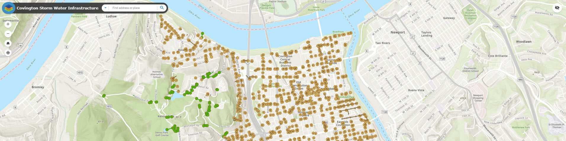
Web Map Application designed specifically to help the City of Covington manage their Storm Water Infrastructure.
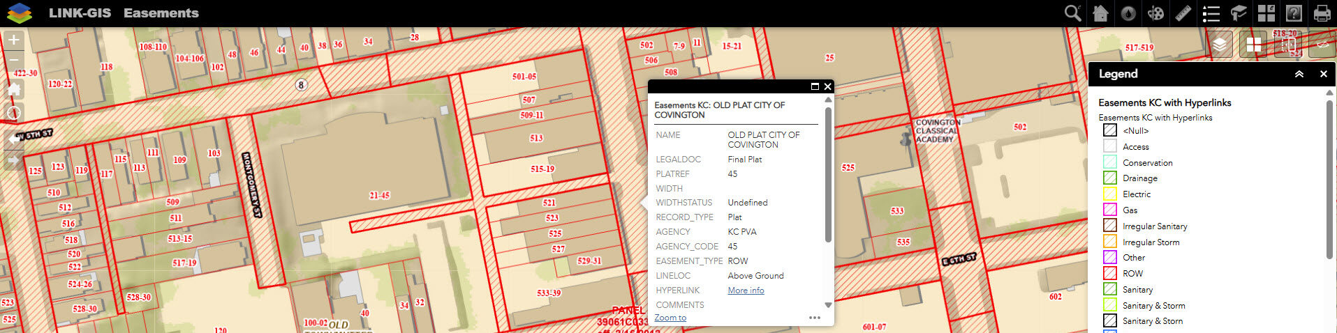
Web Map Application designed specifically to show the location of Easement and Utility Plats. Additional deed research may be required to verify missing or incomplete easement locations and descriptions.
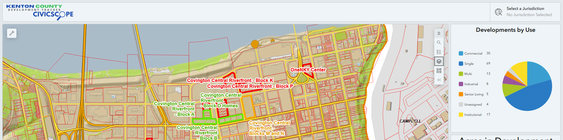
Using data from the Kenton County Development Tracker, CivicScope is a reporting platform that gives local officials the ability to report incorrect or missing development information to GIS Staff through an online review dashboard, survey response form, and workflow automation.