


NKAPC’s GIS staff and Pendleton County Fiscal Court are nearing completion of a GIS-based Reverse-911 system. Reverse-911 provides a way for emergency management services to contact people who live in a certain geographic area in case of emergency. “Reverse-911 is a great way for officials to warn people of imminent danger,” said Joe Busemeyer, one […]
Kenton Fiscal Court, NKAPC to Pursue Assets Management Program with GPS
Kenton County Fiscal Court and NKAPC’s GIS staff are pursuing an assets management effort. The result of the collaboration will be a database that public works’ personnel can use to track maintenance activities and costs for each of the county’s assets as well as a highly accurate digital map that identifies the location of each. […]
LINK-GIS Partnership Approves New Operating and Financing Agreements
After almost 25 years and considerable growth in its operations, Northern Kentucky’s LINK-GIS is operating under new partnership accords. Interlocal agreements creating separate LINK-GIS partnerships for Campbell and Kenton Counties were signed recently by all parties and are awaiting signature by Kentucky’s Attorney General. The new operating agreements reflect LINK-GIS’s growing diversity and the need […]
Kenton County Library Provides Ready Access to LINK-GIS Data and Maps
Officials at the Covington branch of the Kenton County Library are working with NKAPC staff to make available easy computer access to Area Planning’s award-winning LINK-GIS. They are also learning how the computerized mapping system can assist them in serving their customers. “I met recently with (the Covington branch’s) business section head Ann Schoenenberger,” said […]
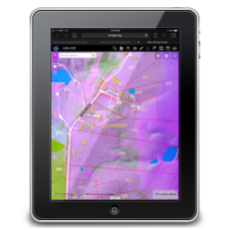
LINK-GIS to Receive Images from Spring Aerial Photography
Campbell and Kenton Counties will soon begin receiving products from NKAPC’s spring aerial photography and LiDAR efforts. Images and data from the upgrade effort could begin showing up on the LINK-GIS website as early as September. LiDAR is a new method of collecting the elevation data used to create accurate contour lines and other three […]
LINK-GIS Visioning Workshop Sets Stage for Improvements to System
Several dozen officials from organizations and agencies participating in LINK-GIS met for two days last month to envision the system’s future. Besides the partner organizations that built and fund the computer mapping system, the audience included some of its heaviest users. “Officials from ESRI’s (Environmental Systems Research Institute) office in St. Louis facilitated the workshop,” […]
LINK-GIS Contracting for Updated Aerial Photography and Other Data
NKAPC staff is in the final steps of negotiating a contract with PhotoScience, Inc. of Lexington to provide new aerial photography and updated data for Campbell and Kenton Counties. This is the first update of information for the system since aerials were flown in 2004. The new information will be available later this year. “We’re […]
Lexington, NKAPC Staffs Collaborate on Database Integration Efforts
What started as a simple peer-to-peer visit four years ago has become an ongoing collaboration between NKAPC planning staff and their counterparts with the Lexington-Fayette Urban County Government. Lexington’s planners visited NKAPC most recently in early December. “Several of their planners were looking at tracking some subdivision, zoning, and historic issues when they contacted us […]
GIS Staff Provides Pendleton County Emergency Services with GPS Data
Area Planning’s GIS department is working to assist emergency services providers in Pendleton County improve their response times. The work is being pursued under the latest of a series of professional services contracts between Pendleton County Fiscal Court and NKAPC. “I meet each year with members of the Fiscal Court to discuss what GIS projects […]
USGS Provides $20,000 Towards New Campbell, Kenton Aerial Photography
The US Geological Survey (USGS) has granted NKAPC $20,000 towards the cost of new digital orthophotography for Campbell and Kenton Counties. Orthophotos constitute the base layer of geographic information systems (GIS). Staff is developing contract plans for new photography to be flown next spring for LINK-GIS. “Bruce Bauch, the Kentucky representative for USGS, suggested that […]