A Northern Kentucky Geographic Information System
We’re All Connected
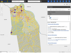
Explore
Explore the LINK-GIS Experience map viewer to easily search addresses, PIDNs and Owner Names, find property information and print beautiful maps.
Order Maps & Data
Choose from a wide selection of maps and digital data. Aerials, LiDAR and planimetric data by tile or county-wide. Custom maps are also available.
Free Downloadable Maps
Find County and City maps, Road maps, Parks and Recreation, Voting Precincts and Historic maps. Maps can be downloaded for free.
Maps & Apps
View our online selection of Maps & Applications that are available publicly at no cost.
LINK-GIS Map Viewer Experience (New)
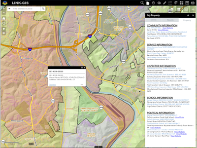
LINK-GIS Map Viewer (Classic)
Development Tracker
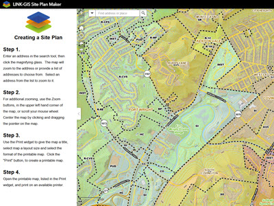
Site Plan Maker
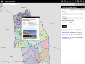
Voting Information