

Tags
County Boundary, county, boundary, Pendleton
Summary
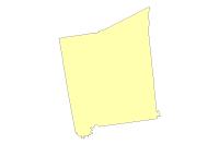
County boundary for Pendleton County
Description
This dataset represents the county boundary for Pendleton County, Kentucky. The east, south and west boundaries are from the KY DGI County boundary dataset. The northern boundary along the Campbell County is also part of the KY DGI County boundary dataset. The north boundary along the Kenton County border is from the 1996 Kenton County Boundary survey conducted by Berling Engineers.
Credits
Pendleton County, LINK-GIS, PDS
Use limitations
LINK-GIS makes no representations, guarantees, or warranties as to the accuracy, completeness, currency, or suitability of information provided. LINK-GIS specifically disclaims any and all liability for any claims or damages that may result from providing this information, including any websites maintained by third parties and linked to this data. LINK-GIS makes no effort to independently verify, and does not exert editorial control over information on pages outside of the “linkgis.org” domain.
LINK-GIS value added data, LINK-GIS and any of its partners or employees except no liability for use of this data
Extent
West -84.532612 East -84.195088
North 38.874867 South 38.529253
Scale Range
There is no scale range for this item.