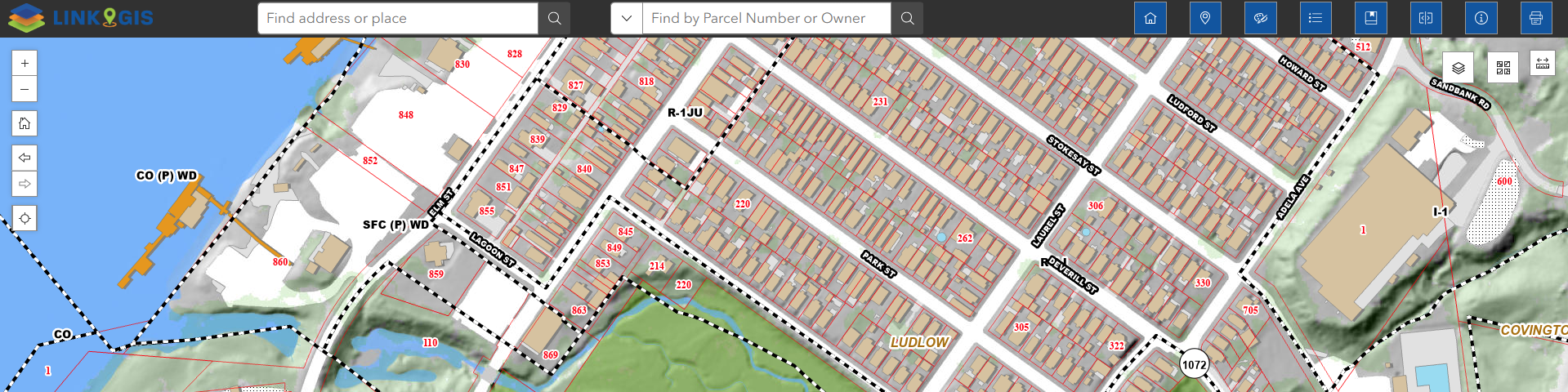
Experience the NEW LINK-GIS map viewer, utilizing the latest mapping application technology. The sleek new design allows users to easily search addresses, PIDNs and Owner Names, find property information and print beautiful maps. There are numerous layers to view, including zoning, flood zones, voting precincts, and more. Users still have the options to customize their maps and export to PDF, or simply print their maps.
Map Viewer (Classic) – Retiring on June 30th, 2026
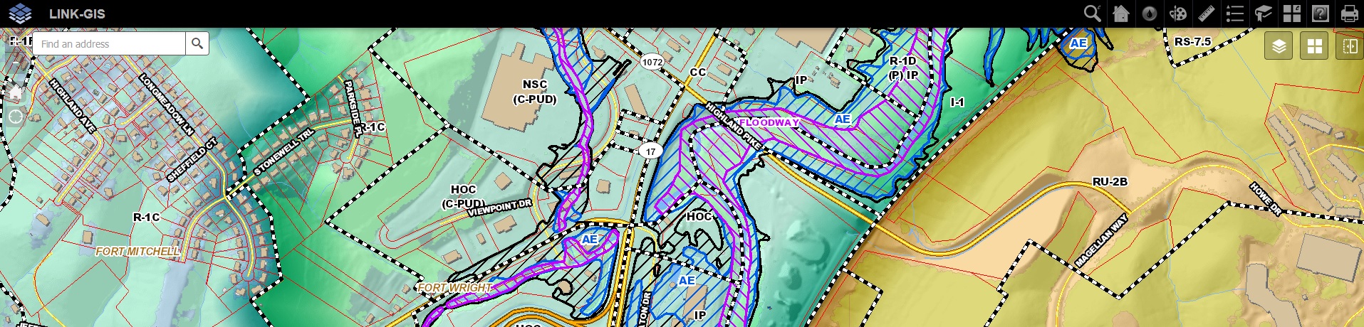
The LINK-GIS map viewer is designed to allow users to search addresses, PIDNs and Owner Names for Kenton, Campbell and Pendleton Counties. Users also have access to dozens of other data layers, including zoning, flood zones, voting precincts, control monuments, places of interest, as well as, an array of tools to customize and print a map.
The Kenton County Development Tracker is designed to allow users to search development activity in Kenton County. This platform will act as a tool to help citizens, the business community, and local officials understand development activity through a near real-time mapping platform. The tracker includes essential data points, such as: Subdivision Name, Current Number of Lots Built, Total Lots Planned, Percentage of Planned Lots Built, Total Acreage, and Jurisdiction. Development activity shown on the map is based primarily on one of two official actions – 1) issuance of a final building permit (Certificate of Occupancy), or 2) final approval of a Kenton County Planning Commission application by the appropriate administrative body (usually a city council, or the fiscal court).
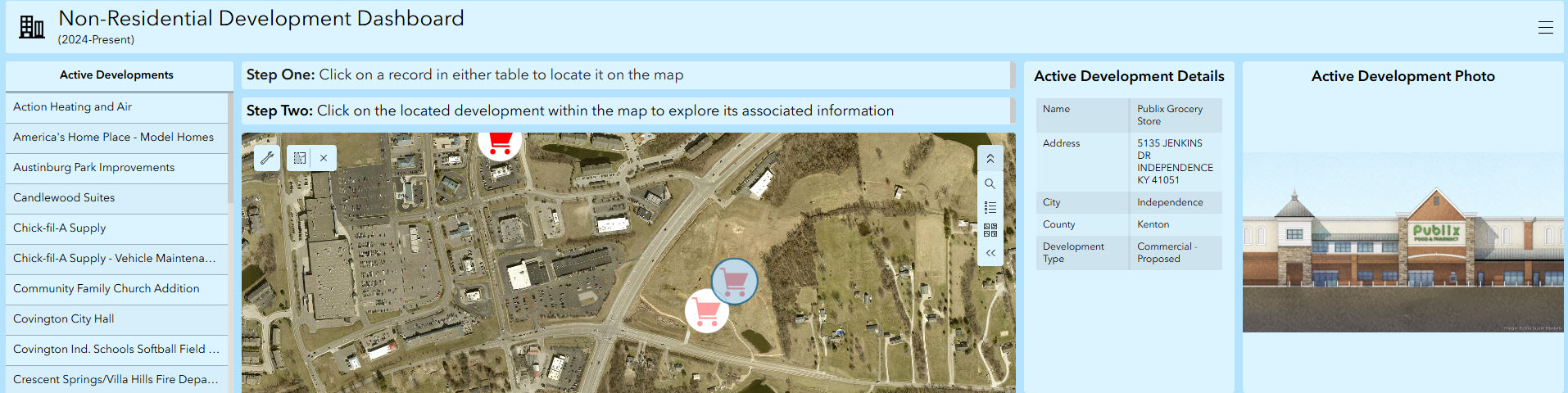
The Non-Residential Development Dashboard, based on the Kenton County Development Tracker, is a web-based application intended to showcase various non-residential projects underway throughout Kenton County. The dashboard highlights commercial, industrial, and institutional projects that are currently underway, while also showcasing projects that remain in their early stages, some of which will include associated RFP/opportunity information. This application is filterable by project name, with icons highlighting the type of project.
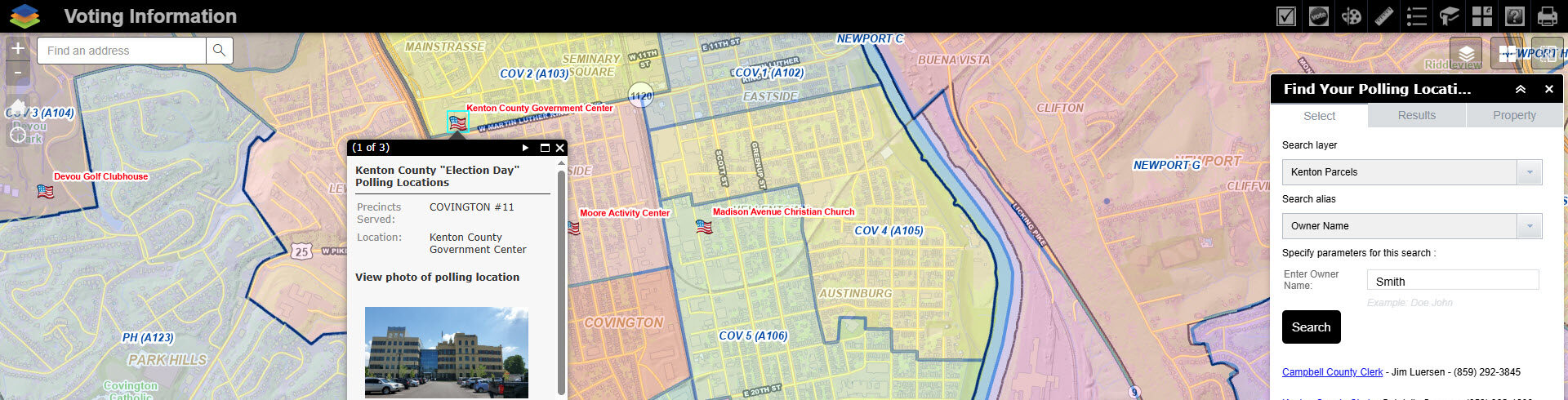
The Voting Information map shows voting precincts and polling locations in Campbell, Kenton, and Pendleton Counties. This easy to use map allows the user to search polling locations by clicking on precincts on the map, or search by precinct name in the Find Polling Location.
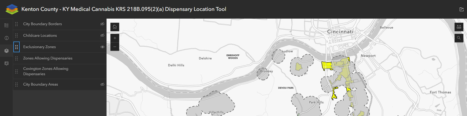
The Kenton County KY Medical Cannabis app is designed to show the zoning locations that allow for Medical Cannabis KRS 218B.095(2)(a) Dispensary uses in Kenton County KY only. The app also shows exclusionary zones (1000′ buffers around school and daycare parcels) where dispensaries are not allowed.
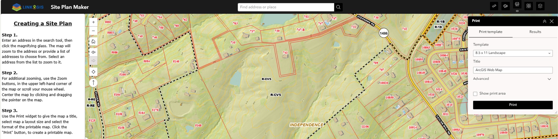
The Site Plan map viewer allows users to create a printable site plan of a property in Kenton or Campbell County.
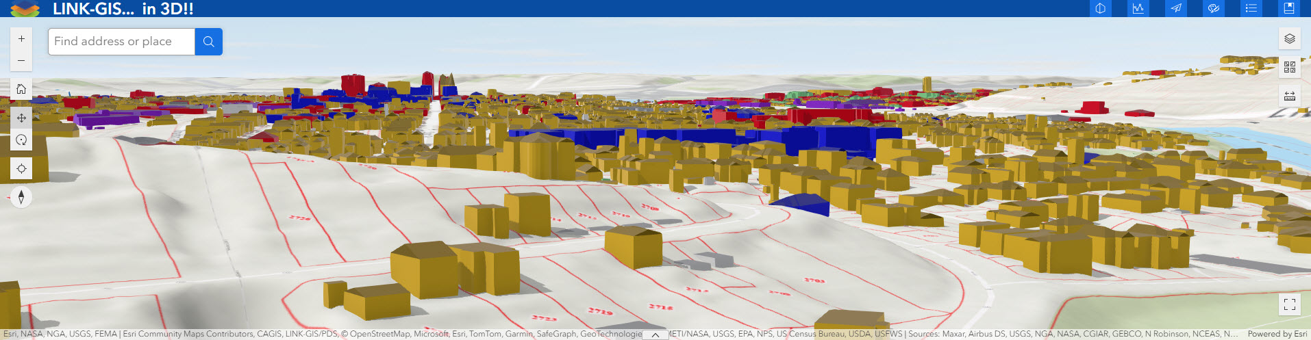
Explore Northern Kentucky with this new 3D Map Viewer. View 3D buildings and see how the hills and valleys define the region! There are several new tools available, including the ability to view sun position, weather types, shadow casts, line of sight, elevation profiles and more…
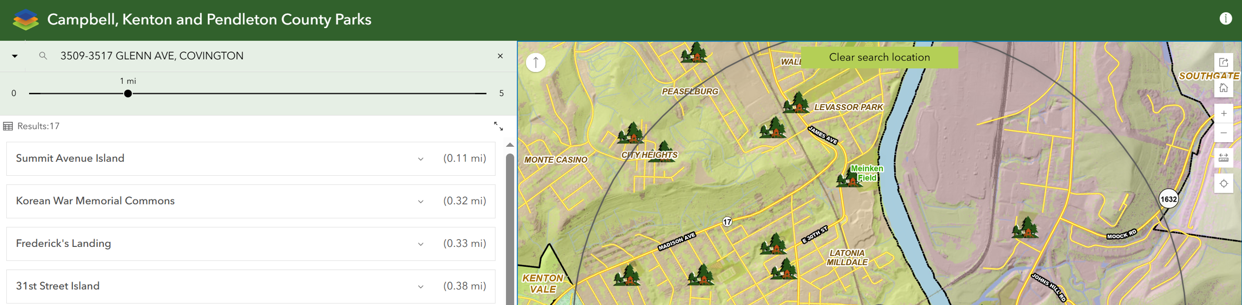
The Park Finder map shows the parks in Campbell, Kenton, and Pendleton Counties. This easy-to-use map allows the user to search by address, parks near current location, or by amenities. Use this link (How to use the Park Finder Map Viewer) to learn more about how to interact with the tools in the Park Finder map viewer.