Tags
LINK-GIS, Planning and Development Services of Kenton County, PDS, Planning & Cadastral, Location, Boundaries, Kentucky, Pendleton County
Summary
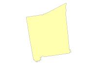
The Pendleton County Boundary layer displays the actual boundaries for Pendleton County. This Data Product is stored, edited and maintained as polygon geometry. This layer is primarily intended for display, analysis, and mapping for current planning purposes, community development projects, and GIS-related analyses, and the data contained in this data set are not intended for property taxation purposes. This Data Product may change at any time, with or without notice.
Description
The Pendleton County Boundary layer displays the actual boundaries for Pendleton County. This Data Product is stored, edited and maintained as polygon geometry. This layer is primarily intended for display, analysis, and mapping for current planning purposes, community development projects, and GIS-related analyses, and the data contained in this data set are not intended for property taxation purposes. This Data Product may change at any time, with or without notice.
About the Kentucky County Formations: Parent County/Counties: Bracken and Campbell. Date Effective: 1799-05-10. Text of Act Creating New County: An ACT for erecting a new County out of the Counties of Campbell and Bracken. Approved December 13, 1798. SECTION 1. BE it enacted by the General Assembly, that from and after the tenth day of May next, all that part of the Counties of Bracken and Campbell within the following Bounds, viz: Beginning on the Ohio River two miles below the mouth of Big Stepstone Creek, thence a direct line across main Licking as far below the main forks of Licking as it is from that place to the mouth of the north fork of Licking above the said Forks, to continue the said line south seventy six degrees west until it shall strike the Scott and Franklin lines, thence with the same to the Harrison county line, thence with the same to Main Licking to the mouth of the north fork thence a direct line to the mouth of Big Stepstone and down the Ohio to the Beginning, shall be one distinct county and called and known by the name of Pendleton, but the said County of Pendleton shall not be entitled to a separate representation until the number of free male inhabitants therein contained above the age of twenty-one years shall entitle them to one Representative agreeable to the Ratio that shall be hereafter established by law.
Counties involved in Boundary Change: Campbell. Boundary Change Approved Date: 1843-01-12. Reference for Boundary Change: “Acts of the Kentucky General Assembly”, 1843, pg. 10
Text of Act Approving Boundary Change: CHAPTER 6. An ACT to provide for running and re-marking the division line between the counties of Campbell and Pendleton. Approved January 12, 1843. Be in enacted by the General Assembly of the Commonwealth of Kentucky, That the Surveyors of the counties of Campbell and Pendleton shall, on or before the first day of May next, proceed to survey and re-mark the division line between the counties of Campbell and Pendleton, and should any division of opinion arise between them, in relation to the said survey, the same shall be submitted, by them, to the Surveyor of Boone county, whose decision shall be final; and after the said survey is completed, they shall report the same to their respective County Courts, together with a bill of the fees and wages of the Surveyors, chainmen, marker, &c., and the said County Courts shall respectively provide, in their next county levies, for the payment of one half of said bill. REF: “Acts of the Kentucky General Assembly”, 1843, pg. 10.
Credits
LINK-GIS, Planning and Development Services of Kenton County (PDS)
Use limitations
All Users hereby acknowledge that PDS, LINK-GIS and any, or all, of its partners or employees accept no liability for use of this Data Product. These Data Products have not been prepared for, and are not suitable for engineering, or surveying purposes. Generally, these Data Products do not represent on-the-ground surveys, but rather represent the approximate relative location of boundaries and features. These Data Products are for general planning purposes only, no other intent is implied. Products should not be used for making financial or any other commitments. PDS, LINK-GIS and any, or all, of its partners or employees provide these Data Products with the understanding that they are not guaranteed to be accurate, correct or complete and conclusions drawn from the Data Products are the responsibility of the User. While every effort has been made to ensure the accuracy, correctness and timeliness of materials presented anywhere within the Data Products, PDS, LINK-GIS and any, or all, of its partners or employees assumes no responsibility for errors or omissions, even if advised of the possibility of such damage.
Extent
West -84.533100 East -84.194948
North 38.999027 South 38.529152
Scale Range
Maximum (zoomed in) 1:5,000
Minimum (zoomed out) 1:500,000

