Tags
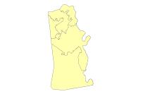
Kentucky Legislative House District Boundaries
Summary
Kentucky Legislative House Districts
Description
House Plan (HH001M01) became law (KRS 5.201 – 5.300) August 23, 2013, with enactment of House Bill 1.
Credits
Kentucky Legislative Research Commission
Geographic Information Systems Office
700 Capitol Ave.
Room 26, Capitol Annex
Frankfort, Kentucky 40601
502-564-8100
Use limitations
LINK-GIS makes no representations, guarantees, or warranties as to the accuracy, completeness, currency, or suitability of information provided. LINK-GIS specifically disclaims any and all liability for any claims or damages that may result from providing this information, including any websites maintained by third parties and linked to this data. LINK-GIS makes no effort to independently verify, and does not exert editorial control over information on pages outside of the “linkgis.org” domain.
LINK-GIS value added data, LINK-GIS and any of its partners or employees except no liability for use of this data
Extent
West -84.627861 East -84.412462
North 39.100716 South 38.788721
Scale Range
Maximum (zoomed in) 1:5,000
Minimum (zoomed out) 1:150,000,000

