

Tags
Parcels, Property, Cadastre, Pendleton County, Kentucky, LINK-GIS, Planning and Development Services of Kenton County, PDS, PCPVA, planningCadastre
Summary
Data created for Pendleton County Property Valuation Administration Office. The Parcels Data Product is used to assess all property equitably, and to maintain accurate parcel information. While the Office of the Property Valuation Administrator has attempted to ensure that the data contained in this file is accurate and reflects the property’s characteristics, the PVA makes no warranties, expressed or implied, concerning the accuracy, completeness, reliability, or suitability of this data. The PVA does not assume any liability associated with the use or misuse of this data.
Description
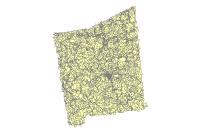
Polygon layer representing real Pendleton County property, as mapped by the PVA office. Data created for Pendleton County Property Valuation Administration Office. The Parcels Data Product is used to assess all property equitably, and to maintain accurate parcel information. While the Office of the Property Valuation Administrator has attempted to ensure that the data contained in this file is accurate and reflects the property’s characteristics, the PVA makes no warranties, expressed or implied, concerning the accuracy, completeness, reliability, or suitability of this data. The PVA does not assume any liability associated with the use or misuse of this data.
Credits
LINK-GIS, Planning and Development Services of Kenton County (PDS), Pendleton County PVA, PCPVA
Use limitations
All Users hereby acknowledge that PDS, LINK-GIS and any, or all, of its partners or employees accept no liability for use of this Data Product. These Data Products have not been prepared for, and are not suitable for engineering, or surveying purposes. Generally, these Data Products do not represent on-the-ground surveys, but rather represent the approximate relative location of boundaries and features. These Data Products are for general planning purposes only, no other intent is implied. Products should not be used for making financial or any other commitments. PDS, LINK-GIS and any, or all, of its partners or employees provide these Data Products with the understanding that they are not guaranteed to be accurate, correct, or complete and conclusions drawn from the Data Products are the responsibility of the User. While every effort has been made to ensure the accuracy, correctness and timeliness of materials presented anywhere within the Data Products, PDS, LINK-GIS and any, or all, of its partners or employees assumes no responsibility for errors or omissions, even if advised of the possibility of such damage.
Extent
| West | -84.534733 | East | -84.195181 |
| North | 38.872579 | South | 38.530439 |
Scale Range
There is no scale range for this item.