

Tags
Kentucky, Campbell County, Kenton County, Geology
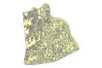
Summary
Developed by the Kentucky Geologic Survey to inventory and identified areas of differing geology.
Description
Polygons denoting areas of differing geology. This data is developed and maintained by the Kentucky Geologic Survey it is the compilation of several 30′ x 60′ maps.
Credits
Kentucky Geologic Survey, LINK-GIS, Planning and Development Services of Kenton County (PDS)
Use limitations
All Users hereby acknowledge that PDS, LINK-GIS and any, or all, of its partners or employees accept no liability for use of this Data Product. These Data Products have not been prepared for, and are not suitable for engineering, or surveying purposes. Generally, these Data Products do not represent on-the-ground surveys, but rather represent the approximate relative location of boundaries and features. These Data Products are for general planning purposes only, no other intent is implied. Products should not be used for making financial or any other commitments. PDS, LINK-GIS and any, or all, of its partners or employees provide these Data Products with the understanding that they are not guaranteed to be accurate, correct or complete and conclusions drawn from the Data Products are the responsibility of the User. While every effort has been made to ensure the accuracy, correctness and timeliness of materials presented anywhere within the Data Products, PDS, LINK-GIS and any, or all, of its partners or employees assumes no responsibility for errors or omissions, even if advised of the possibility of such damage.
Extent
| West | -84.623945 | East | -84.239103 |
| North | 39.118555 | South | 38.790276 |
Scale Range
Maximum (zoomed in) 1:5,000
Minimum (zoomed out) 1:625,000