• Menu
    • Home
    • Online Mapping
      • Explore the Maps
      • Metadata
    • Visit the Lab
    • Order Maps & Data
      • County-Wide Digital Data
      • Digital Data by Tile
      • Featured Maps
      • Historical Maps
      • NKYmapLAB Maps
    • Key Performance Indicators
    • How Do I…
      • Become a Business Client
      • Contact LINK-GIS
      • Find Flood Zones
      • Find My City
      • Find My Polling Location
      • Use the LINK-GIS Map Viewer
      • Use the Park Finder Map Viewer
      • Locate Survey Monuments
      • Retrieve Zoning Information
    • About LINK-GIS
      • About LINK-GIS
      • Contact LINK-GIS
        • Frequently Asked Questions
        • Control Network Recovery
      • LINK-GIS History: Achievements, Articles and Awards
      • Partners
      • GIS Team
    • Awards
  • Menu
    • Home
    • Online Mapping
      • Explore the Maps
      • Metadata
    • Visit the Lab
    • Order Maps & Data
      • County-Wide Digital Data
      • Digital Data by Tile
      • Featured Maps
      • Historical Maps
      • NKYmapLAB Maps
    • Key Performance Indicators
    • How Do I…
      • Become a Business Client
      • Contact LINK-GIS
      • Find Flood Zones
      • Find My City
      • Find My Polling Location
      • Use the LINK-GIS Map Viewer
      • Use the Park Finder Map Viewer
      • Locate Survey Monuments
      • Retrieve Zoning Information
    • About LINK-GIS
      • About LINK-GIS
      • Contact LINK-GIS
        • Frequently Asked Questions
        • Control Network Recovery
      • LINK-GIS History: Achievements, Articles and Awards
      • Partners
      • GIS Team
    • Awards

Duke Energy, NKAPC collaborate for savings on GPS training

July 1, 2014

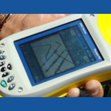
GPS3_sqAn opportunity to coordinate training with Duke Energy and to save money in the process prompted a mapping and GPS certified training course to be held in the office of the Northern Kentucky Area Planning Commission (NKAPC) on May 22nd and 23rd.

This training was led by a Trimble certified MGIS trainer, Jay Riester, who presented the GPS and GIS fundamentals from mission planning to collecting, processing, and exporting data.

Brianna Powers, Data Analyst with Duke stated, “Our initial need stemmed from the desire to collect very accurate points for georeferencing (aligning geographic data to a known location) and accurate asset locations for data integrity. Then we figured everybody’s got assets! Fortunately for us, some other groups in the area were able to join and the class was a huge success.”

The training was attended by representatives from Kenton and Campbell Counties Fiscal Court, Duke Energy, NKAPC, and Northern Kentucky Water District (NKWD). Cindy Minter, Director of Planning and Zoning; and Luke Mantle, Road Department Director, were in attendance to learn how to utilize GPS for asset management and other Campbell County projects. Mantle commented, “Cindy and I both really gained insight from the training.” Most of the attendees had some knowledge of how to utilize GPS for mapping projects, but were interested in a better understanding of the GPS project process.

During the first day’s training, attendees learned basic GPS fundamentals, how to create a project including a data dictionary, how to set up the equipment, and then went to the field to actually collect data. On the second day, attendees focused on utilizing the GPS units for advanced data collection techniques and how to utilize local continuously operating reference stations (CORS) to improve the precision of their positions after collecting real-time GPS points.

NKAPC staff member Steve Lilly, PLS, attended the training and “plans to continue the effort with GPS and utilize this training in the effort of capturing new development within Kenton County, as well as other pertinent mapping projects. GPS is critical to our data quality effort within LINK-GIS.”

Collaboration, Financial Benefit, LINK-GIS News, Uncategorized
Campbell, Collaborate, Continuously Operating Reference Stations, CORS, Duke Energy, Fiscal Court, GPS, Kenton, LINK-GIS, NKAPC, NKWD, PDS, Real-Time GPS Points, Savings, Training, Trimble
“Impressive” data and expertise aid tree canopy study
STEM: Ripe for the picking
  • Home
  • Uncategorized
  • LINK-GIS News
  • Financial Benefit
  • Collaboration
  • Duke Energy, NKAPC collaborate for savings on GPS training

Recent Articles

  • Adjusted Operation Details for LINK-GIS
  • How You Can Vote in the Kenton County General Election-November 3, 2020
  • Adjusted Operation Details for LINK-GIS

Archives

  • November 2020
  • October 2020
  • March 2020
  • January 2020
  • March 2019
  • August 2018
  • June 2018
  • December 2017
  • November 2017
  • September 2017
  • August 2017
  • July 2017
  • May 2017
  • April 2017
  • March 2017
  • February 2017
  • January 2017
  • October 2016
  • August 2016
  • July 2016
  • June 2016
  • March 2016
  • December 2015
  • October 2015
  • August 2015
  • February 2015
  • December 2014
  • October 2014
  • August 2014
  • July 2014
  • May 2014
  • April 2014
  • March 2014
  • February 2014
  • December 2013
  • November 2013
  • September 2013
  • August 2013
  • May 2013
  • March 2013
  • March 2012
  • January 2012
  • December 2011
  • February 2011
  • October 2010
  • September 2010
  • August 2010
  • July 2010
  • June 2010
  • March 2010
  • February 2010
  • January 2010
  • December 2009
  • November 2009
  • October 2009
  • September 2009
  • April 2009
  • March 2009
  • October 2008
  • August 2008
  • July 2008
  • May 2008
  • April 2008
  • March 2008
  • January 2008
  • December 2007
  • October 2007
  • August 2007
  • June 2007
  • May 2007
  • April 2007
  • February 2007
  • January 2007
  • November 2006
  • October 2006
  • August 2006
  • June 2006
  • May 2006
  • April 2006
  • February 2006
  • January 2006
  • December 2005
  • September 2005
  • April 2005
  • March 2005
  • February 2005
  • October 2003

LINK-GIS Disclaimer  •  Copyright @2016  •  Planning and Development Services of Kenton County