• Menu
    • Home
    • Online Mapping
      • Explore the Maps
      • Metadata
    • Visit the Lab
    • Order Maps & Data
      • County-Wide Digital Data
      • Digital Data by Tile
      • Featured Maps
      • Historical Maps
      • NKYmapLAB Maps
    • Key Performance Indicators
    • How Do I…
      • Become a Business Client
      • Contact LINK-GIS
      • Find Flood Zones
      • Find My City
      • Find My Polling Location
      • Use the LINK-GIS Map Viewer
      • Use the Park Finder Map Viewer
      • Locate Survey Monuments
      • Retrieve Zoning Information
    • About LINK-GIS
      • About LINK-GIS
      • Contact LINK-GIS
        • Frequently Asked Questions
        • Control Network Recovery
      • LINK-GIS History: Achievements, Articles and Awards
      • Partners
      • GIS Team
    • Awards
  • Menu
    • Home
    • Online Mapping
      • Explore the Maps
      • Metadata
    • Visit the Lab
    • Order Maps & Data
      • County-Wide Digital Data
      • Digital Data by Tile
      • Featured Maps
      • Historical Maps
      • NKYmapLAB Maps
    • Key Performance Indicators
    • How Do I…
      • Become a Business Client
      • Contact LINK-GIS
      • Find Flood Zones
      • Find My City
      • Find My Polling Location
      • Use the LINK-GIS Map Viewer
      • Use the Park Finder Map Viewer
      • Locate Survey Monuments
      • Retrieve Zoning Information
    • About LINK-GIS
      • About LINK-GIS
      • Contact LINK-GIS
        • Frequently Asked Questions
        • Control Network Recovery
      • LINK-GIS History: Achievements, Articles and Awards
      • Partners
      • GIS Team
    • Awards

Delivery of GIS data provides community with tree canopy inventory

December 1, 2014

canopyA recent grant from the USDA Forest Service through the Kentucky Division of Forestry to the Northern Kentucky Urban and Community Forestry Council has provided LINK-GIS partners with high resolution data on tree cover. SavATree, in collaboration with the University of Vermont’s Spatial Analysis Laboratory, mapped Northern Kentucky’s land cover.

“We’re pleased to receive these new data,” said Dennis Gordon, FAICP, PDS executive director and managing partner of the LINK-GIS partnerships. “This collaborative effort with Northern Kentucky’s Urban and Community Forestry Council will be extremely helpful to PDS and our GIS partners as more and more emphasis is focused on air and water quality issues.”

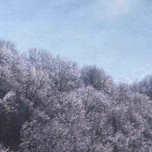
The project succeeded in mapping land cover for Northern Kentucky with a high level of accuracy. The project was able to achieve its goals by leveraging existing data provided by LINK-GIS. The 7‐class land cover will be useful for producing tree canopy and land cover metrics. The percent of forest was broken down for each city, watershed, block group, and even down to the parcel level.

Tree canopy data is now available on the base map of the LINK-GIS website. Questions should be addressed to the GIS staff at PDS.

Collaboration, Data Development, Technology
Data, Delivery, GIS, Inventory, Land Cover, LINK-GIS, PDS, Tree Canopy, Tree Cover, University of Vermont, Urban and Community Forestry Council, USDA Forest Service
GIS department provides HBA information on available subdivision lots
Analytics, economic development to be focus of NKY mapLAB initiative
  • Home
  • Technology
  • Collaboration
  • Data Development
  • Delivery of GIS data provides community with tree canopy inventory

Recent Articles

  • Adjusted Operation Details for LINK-GIS
  • How You Can Vote in the Kenton County General Election-November 3, 2020
  • Adjusted Operation Details for LINK-GIS

Archives

  • November 2020
  • October 2020
  • March 2020
  • January 2020
  • March 2019
  • August 2018
  • June 2018
  • December 2017
  • November 2017
  • September 2017
  • August 2017
  • July 2017
  • May 2017
  • April 2017
  • March 2017
  • February 2017
  • January 2017
  • October 2016
  • August 2016
  • July 2016
  • June 2016
  • March 2016
  • December 2015
  • October 2015
  • August 2015
  • February 2015
  • December 2014
  • October 2014
  • August 2014
  • July 2014
  • May 2014
  • April 2014
  • March 2014
  • February 2014
  • December 2013
  • November 2013
  • September 2013
  • August 2013
  • May 2013
  • March 2013
  • March 2012
  • January 2012
  • December 2011
  • February 2011
  • October 2010
  • September 2010
  • August 2010
  • July 2010
  • June 2010
  • March 2010
  • February 2010
  • January 2010
  • December 2009
  • November 2009
  • October 2009
  • September 2009
  • April 2009
  • March 2009
  • October 2008
  • August 2008
  • July 2008
  • May 2008
  • April 2008
  • March 2008
  • January 2008
  • December 2007
  • October 2007
  • August 2007
  • June 2007
  • May 2007
  • April 2007
  • February 2007
  • January 2007
  • November 2006
  • October 2006
  • August 2006
  • June 2006
  • May 2006
  • April 2006
  • February 2006
  • January 2006
  • December 2005
  • September 2005
  • April 2005
  • March 2005
  • February 2005
  • October 2003

LINK-GIS Disclaimer  •  Copyright @2016  •  Planning and Development Services of Kenton County